Area Overview for CO7 8BB
Photos of CO7 8BB
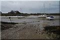
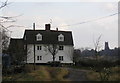
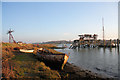

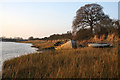
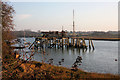

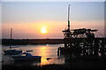
21 photos from this area
Area Information
Key information about the CO7 8BB including its size, population, and administrative classification.
- Area Type
- Postcode
- Area Size
- 72.6 hectares
- Population
- 2464
- Population Density
- 363 people/km²
House Prices in CO7 8BB
9
Properties
£469,000
Average Sold Price
£469,000
Lowest Price
£469,000
Highest Price
Showing 9 properties
| Address | Type | Beds | Baths | Last Sale Price | Last Sale Date | |
|---|---|---|---|---|---|---|
| Ford House, Ford Lane, Alresford, CO7 8BB | house | - | - | £469,000 | Dec 2006 | |
| Annexe, Ford House, Ford Lane, Alresford, CO7 8BB | Flat | - | - | - | - | |
| Store And Premises At, Boat Yard And Clubhouse, Ford Lane, Alresford, CO7 8BB | shop | - | - | - | - | |
| Clanbournes, Stores And Premises, Alresford Quarry, Ford Lane, Alresford, CO7 8BB | Industrial | - | - | - | - | |
| Anglian Aggregate Bagging Co Ltd, Bagging Plant And Premises, Alresford Quarry, Ford Lane, Alresford, CO7 8BB | Industrial | - | - | - | - | |
| Brett Aggregates, Alresford Quarry, Ford Lane, Alresford, CO7 8BB | Industrial | - | - | - | - | |
| The Ford, Ford Lane, Alresford, CO7 8BB | Detached | - | - | - | - | |
| 1, Ford Cottages, Ford Lane, Alresford, CO7 8BB | Semi-detached | - | - | - | - | |
| 2, Ford Cottages, Ford Lane, Alresford, CO7 8BB | house | - | - | - | - |
Energy Efficiency in CO7 8BB
Amenities
Schools
| Rank | School | Type | Entry gender | Ages |
|---|
Explore more schools in this area
Go to Schools tabDemographics
Household Size
Two person
most common
Accommodation Type
Houses
most common
Tenure
87
majority
Ethnic Group
White
most common
Religion
N/A
most common
Household Composition
N/A
most common
Age
47
median
Adults (30-64 years)
most common
Household Deprivation
N/A
with no deprivation
NS-SEC
32
in Lower managerial occupations
Explore more demographic insights in this area
Go to Demographics tabPlanning
Planning Constraints
- Flood RiskPremium
- Ramsar Wetland SitesPremium
- Area of Outstanding Natural BeautyPremium
- Protected Nature ReservePremium
- Protected WoodlandPremium