Area Overview for CO7 6TU
Photos of CO7 6TU
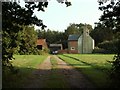
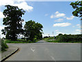

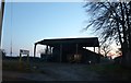
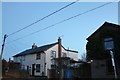
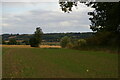


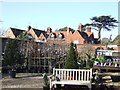
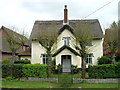
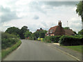
20 photos from this area
Area Information
Key information about the CO7 6TU including its size, population, and administrative classification.
- Area Type
- Postcode
- Area Size
- 7.7 hectares
- Population
- 1522
- Population Density
- 250 people/km²
House Prices in CO7 6TU
27
Properties
£463,080
Average Sold Price
£75,000
Lowest Price
£1,100,000
Highest Price
Showing 27 properties
| Address | Type | Beds | Baths | Last Sale Price | Last Sale Date | |
|---|---|---|---|---|---|---|
| Bobtails, White Horse Road, East Bergholt, CO7 6TU | Detached | 6 | 2 | £1,100,000 | Jan 2023 | |
| Nook Cottage, White Horse Road, East Bergholt, CO7 6TU | house | 4 | 2 | £560,000 | Nov 2021 | |
| 6 White Horse Road, East Bergholt, CO7 6TU | Semi-detached | 4 | 1 | £453,500 | Sep 2021 | |
| Northcot, White Horse Road, East Bergholt, CO7 6TU | Cottage | 2 | 1 | £430,000 | May 2021 | |
| Asbyrgi, White Horse Road, East Bergholt, CO7 6TU | house | - | - | £677,000 | Dec 2020 | |
| Pheasants, White Horse Road, East Bergholt, CO7 6TU | Detached | 4 | - | £635,000 | Jun 2019 | |
| 2, Woodbine Cottages, White Horse Road, East Bergholt, CO7 6TU | Detached | 3 | 2 | £600,000 | Feb 2019 | |
| Olfrea, White Horse Road, East Bergholt, CO7 6TU | Detached | 5 | 2 | £550,000 | Apr 2016 | |
| White Horse House, White Horse Road, East Bergholt, CO7 6TU | house | 6 | - | £950,000 | Aug 2013 | |
| 10 White Horse Road, East Bergholt, CO7 6TU | house | - | - | £111,000 | Apr 2011 |
Page 1 of 3
Energy Efficiency in CO7 6TU
Amenities
Schools
| Rank | School | Type | Entry gender | Ages |
|---|
Explore more schools in this area
Go to Schools tabDemographics
Household Size
Two person
most common
Accommodation Type
Houses
most common
Tenure
74
majority
Ethnic Group
White
most common
Religion
N/A
most common
Household Composition
N/A
most common
Age
47
median
Adults (30-64 years)
most common
Household Deprivation
N/A
with no deprivation
NS-SEC
42
in Lower managerial occupations
Explore more demographic insights in this area
Go to Demographics tabPlanning
Planning Constraints
- Flood RiskPremium
- Ramsar Wetland SitesPremium
- Area of Outstanding Natural BeautyPremium
- Protected Nature ReservePremium
- Protected WoodlandPremium