Area Overview for CO6 2LQ
Photos of CO6 2LQ
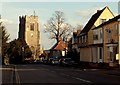
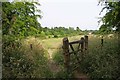
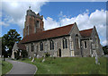
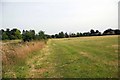
63 photos from this area
Area Information
Key information about the CO6 2LQ including its size, population, and administrative classification.
- Area Type
- Postcode
- Area Size
- 16.9 hectares
- Population
- 1791
- Population Density
- 111 people/km²
House Prices in CO6 2LQ
22
Properties
£280,339
Average Sold Price
£172,000
Lowest Price
£390,000
Highest Price
Showing 22 properties
| Address | Type | Beds | Baths | Last Sale Price | Last Sale Date | |
|---|---|---|---|---|---|---|
| 69A Tey Road, Earls Colne, CO6 2LQ | Bungalow | - | - | £332,068 | Oct 2017 | |
| 36 Tey Road, Earls Colne, CO6 2LQ | Bungalow | - | - | £320,000 | Jun 2017 | |
| 57 Tey Road, Earls Colne, CO6 2LQ | Bungalow | - | - | £280,000 | Jul 2016 | |
| 65 Tey Road, Earls Colne, CO6 2LQ | Detached | 4 | - | £390,000 | May 2016 | |
| 55 Tey Road, Earls Colne, CO6 2LQ | Chalet | 4 | - | £350,000 | Sep 2015 | |
| 32 Tey Road, Earls Colne, CO6 2LQ | Detached | 4 | 3 | £235,000 | Nov 2013 | |
| 63 Tey Road, Earls Colne, CO6 2LQ | Detached | - | - | £300,000 | Oct 2007 | |
| Brookfield, 75 Tey Road, Earls Colne, CO6 2LQ | Detached | - | - | £265,000 | Jun 2007 | |
| 69 Tey Road, Earls Colne, CO6 2LQ | Detached | - | - | £280,000 | Dec 2006 | |
| 61 Tey Road, Earls Colne, CO6 2LQ | Bungalow | - | - | £250,000 | Feb 2004 |
Page 1 of 3
Energy Efficiency in CO6 2LQ
Amenities
Schools
| Rank | School | Type | Entry gender | Ages |
|---|
Explore more schools in this area
Go to Schools tabDemographics
Household Size
Two person
most common
Accommodation Type
Houses
most common
Tenure
84
majority
Ethnic Group
White
most common
Religion
N/A
most common
Household Composition
N/A
most common
Age
47
median
Adults (30-64 years)
most common
Household Deprivation
N/A
with no deprivation
NS-SEC
40
in Lower managerial occupations
Explore more demographic insights in this area
Go to Demographics tabPlanning
Planning Constraints
- Flood RiskPremium
- Ramsar Wetland SitesPremium
- Area of Outstanding Natural BeautyPremium
- Protected Nature ReservePremium
- Protected WoodlandPremium