Area Overview for CO5 8BG
Photos of CO5 8BG
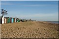
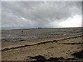
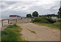

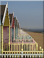
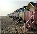
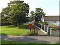
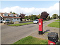
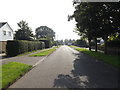
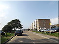
50 photos from this area
Area Information
Key information about the CO5 8BG including its size, population, and administrative classification.
- Area Type
- Postcode
- Area Size
- 2.8 hectares
- Population
- 1413
- Population Density
- 2451 people/km²
House Prices in CO5 8BG
28
Properties
£418,158
Average Sold Price
£123,000
Lowest Price
£825,000
Highest Price
Showing 28 properties
| Address | Type | Beds | Baths | Last Sale Price | Last Sale Date | |
|---|---|---|---|---|---|---|
| Alexandra Lodge, 6A Alexandra Avenue, West Mersea, CO5 8BG | Detached | 4 | 2 | £825,000 | Aug 2025 | |
| Pippins, 10 Alexandra Avenue, West Mersea, CO5 8BG | Detached | 3 | 2 | £595,000 | Jan 2025 | |
| 2A Alexandra Avenue, West Mersea, CO5 8BG | Bungalow | 3 | 2 | £610,000 | Aug 2024 | |
| 11 Alexandra Avenue, West Mersea, CO5 8BG | Bungalow | 3 | - | £670,000 | Apr 2022 | |
| Normandy, 16 Alexandra Avenue, West Mersea, CO5 8BG | Bungalow | - | - | £470,000 | Oct 2017 | |
| 3 Alexandra Avenue, West Mersea, CO5 8BG | Detached | 3 | 2 | £617,000 | Sep 2017 | |
| 15 Alexandra Avenue, West Mersea, CO5 8BG | house | - | - | £710,000 | Aug 2017 | |
| White Croft, 4A Alexandra Avenue, West Mersea, CO5 8BG | Detached | 4 | 2 | £480,000 | Dec 2016 | |
| Merle, 20 Alexandra Avenue, West Mersea, CO5 8BG | Bungalow | - | - | £250,000 | Jul 2016 | |
| Greenchairs, 12 Alexandra Avenue, West Mersea, CO5 8BG | house | - | - | £400,000 | Dec 2014 |
Page 1 of 3
Energy Efficiency in CO5 8BG
Amenities
Schools
| Rank | School | Type | Entry gender | Ages |
|---|
Explore more schools in this area
Go to Schools tabDemographics
Household Size
Two person
most common
Accommodation Type
Houses
most common
Tenure
88
majority
Ethnic Group
White
most common
Religion
N/A
most common
Household Composition
N/A
most common
Age
47
median
Adults (30-64 years)
most common
Household Deprivation
N/A
with no deprivation
NS-SEC
38
in Lower managerial occupations
Explore more demographic insights in this area
Go to Demographics tabPlanning
Planning Constraints
- Flood RiskPremium
- Ramsar Wetland SitesPremium
- Area of Outstanding Natural BeautyPremium
- Protected Nature ReservePremium
- Protected WoodlandPremium