Area Overview for CO5 8AY
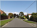
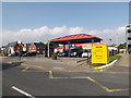
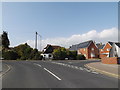
Photos of CO5 8AY


Area Information
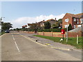
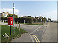
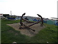
CO5 8AY sits within West Mersea, a historic coastal town on Mersea Island in Essex. This civil parish is a tidal island connected to the mainland via the Strood causeway, a structure historically dating from the Saxon period. The postcode represents a very small residential cluster covering just 4746 m² of land. Despite its tiny footprint, the area holds a population of 1413 people, creating an exceptionally high population density of 297,745 people per km². You are looking at a settlement with deep roots, where evidence of human activity stretches back to the Bronze Age and the days of the Romans. The community has survived Norse raids, the Black Death, and the dissolution of abbeys to become the seaside resort known today. Daily life centres around a maritime heritage, with oyster fishing and boating defining the local character. The High Street and Church Street remain the historic core, anchored by St Peter and St Paul Church, which dates to the 11th century. While the area is defined by its isolation during high tide, the parish offers a blend of rural quietness and coastal access. Residents enjoy a distinct island atmosphere supported by traditional events like the annual regatta. For someone seeking homes in CO5 8AY, the reality is a compact, time-tested community where the past remains visibly present in the architecture and the landscape. The concentration of homes is intense due to the small total area, meaning streets are close together and neighbours are inevitably part of your daily routine.
- Area Type
- Postcode
- Area Size
- 4746 m²
- Population
- 1413
- Population Density
- 2451 people/km²
The housing market in CO5 8AY is characterised almost exclusively by Houses. With an accommodation type listed solely as Houses, you will not find flats or purpose-built apartments in this specific postcode cluster. The high home ownership rate of 88% reinforces that this is an owner-occupied area rather than a rental hub. This means the supply of properties is driven by existing owner-occupiers or those moving locally, rather than investor portfolios or student rentals. The small physical area of 4746 m² further constrains the total number of available homes, making every listing significant. For buyers looking at homes in CO5 8AY, the market behaves differently than in urban centres. The concentration of density at 297,745 people per km² is immense for such a small land mass, implying that properties are built close together on the available island terrain. This small residential cluster is likely composed of established bungalows or period homes typical of a historic parish. The absence of flats or modern high-density blocks indicates a legacy housing stock. When you examine the property market here, you are looking at a traditional English seaside town environment. Transactions will depend on local estate agents marketing individual houses within this tight geographical boundary. The market is not speculative; it reflects the needs of the 1413 permanent residents who require specific types of detached or semi-detached housing suitable for an island lifestyle.
House Prices in CO5 8AY
Showing 10 properties
| Address | Type | Beds | Baths | Last Sale Price | Last Sale Date | |
|---|---|---|---|---|---|---|
| 7 King Charles Road, West Mersea, CO5 8AY | Detached | 3 | 2 | £380,000 | Feb 2019 | |
| 1 King Charles Road, West Mersea, CO5 8AY | Detached | 3 | 1 | £240,000 | Jun 2014 | |
| 10 King Charles Road, West Mersea, CO5 8AY | house | - | - | £241,200 | Feb 2011 | |
| 8 King Charles Road, West Mersea, CO5 8AY | Detached | - | - | £88,000 | Apr 1998 | |
| 4 King Charles Road, West Mersea, CO5 8AY | house | - | - | £78,000 | Mar 1996 | |
| 12 King Charles Road, West Mersea, CO5 8AY | Detached | - | - | - | - | |
| 9 King Charles Road, West Mersea, CO5 8AY | Detached | - | - | - | - | |
| 3 King Charles Road, West Mersea, CO5 8AY | Semi-detached | - | - | - | - | |
| 6 King Charles Road, West Mersea, CO5 8AY | Detached | 3 | 1 | - | - | |
| 5 King Charles Road, West Mersea, CO5 8AY | Semi-detached | - | - | - | - |
Energy Efficiency in CO5 8AY
Your daily life in CO5 8AY revolves around a selection of amenities that keep the island self-sufficient without requiring long drives to the mainland. For retail needs, you have five nearby shops within practical reach. Notable options include Spar, the East of England Co-operative Co, and another Spar store. These outlets provide essentials ranging from groceries to basic household items. You do not need to travel far for basic provisions, which supports the low-carbon lifestyle often found in coastal communities. Leisure and transport hubs are also nearby, adding depth to your options. Three ferry landing sites serve the island, including the East Mersea Ferry Landing, Point Clear Ferry Landing, and Brightlingsea Ferry Landing. These facilities allow you to cross to the mainland at times other than low tide. For those who prefer rail travel, Wivenhoe and Alresford stations are key interchange points connected by bus services running along the B1025. Dining and casual commerce are likely supported by parochial traditions, though specific restaurants are not listed in the immediate amenity data. The presence of oyster fishing heritage and the Mersea Museum offers cultural trails if you enjoy history. Shopping trips are limited but efficient, relying on the few local retailers available alongside the convenience of ferry crossings.
Amenities
Schools
| Rank | School | Type | Entry gender | Ages |
|---|
Explore more schools in this area
Go to Schools tabDemographics
The community in CO5 8AY is defined by an older resident profile compared to many national averages. The median age is 47 years, confirming that Adults aged 30 to 64 form the most common age range. This demographic skew suggests a neighbourhood where families and established professionals live, rather than young singles or transient populations. Home ownership stands at 88%, indicating a highly stable population deeply rooted in the area. This high level of ownership matches the accommodation type, which consists primarily of Houses rather than flats or urban apartments. You can expect a predominantly white ethnic group living here, reflecting the close-knit nature of this island community. With 88% of households owning their homes, the area presents itself as a place for long-term settlement rather than a letting market. This statistic usually correlates with lower transient rates and higher levels of local investment in property maintenance. The high density combined with a mature age profile suggests quiet streets where daily interactions are frequent. The 1413 residents live in close proximity, creating a tight network of neighbours. This demographic makeup supports a slower pace of life, away from the rapid turnover seen in cities. Buyers considering homes in CO5 8AY should note that purchasing a property here is likely entering a stable market where owners rarely move quickly. The lack of rental stock means competition may focus heavily on those ready to commit to home ownership.
Household Size
Accommodation Type
Tenure
Ethnic Group
Religion
Household Composition
Age
Household Deprivation
NS-SEC
Explore more demographic insights in this area
Go to Demographics tabPlanning
Planning Constraints
- Flood RiskPremium
- Ramsar Wetland SitesPremium
- Area of Outstanding Natural BeautyPremium
- Protected Nature ReservePremium
- Protected WoodlandPremium