Area Overview for CO2 0DT
Photos of CO2 0DT
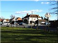
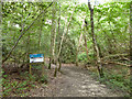
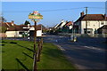
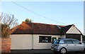
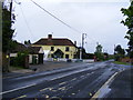
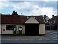
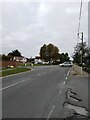
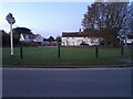
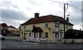
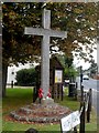
10 photos from this area
Area Information
Key information about the CO2 0DT including its size, population, and administrative classification.
- Area Type
- Postcode
- Area Size
- 4.2 hectares
- Population
- 1468
- Population Density
- 907 people/km²
House Prices in CO2 0DT
39
Properties
£374,047
Average Sold Price
£106,500
Lowest Price
£922,500
Highest Price
Showing 39 properties
| Address | Type | Beds | Baths | Last Sale Price | Last Sale Date | |
|---|---|---|---|---|---|---|
| 77 High Road, Layer De La Haye, CO2 0DT | Bungalow | - | - | £475,000 | Jan 2025 | |
| 69 High Road, Layer De La Haye, CO2 0DT | Bungalow | - | - | £575,000 | Jun 2022 | |
| Olimai House, 84A High Road, Layer De La Haye, CO2 0DT | Detached | 4 | - | £922,500 | Dec 2020 | |
| Stonewell Cottage, 86 High Road, Layer De La Haye, CO2 0DT | Detached | 4 | 3 | £700,000 | Nov 2018 | |
| 66 High Road, Layer De La Haye, CO2 0DT | Semi-detached | 3 | - | £395,000 | Aug 2018 | |
| 89 High Road, Layer De La Haye, CO2 0DT | Bungalow | 3 | 1 | £445,000 | Apr 2018 | |
| Winston House, 54 High Road, Layer De La Haye, CO2 0DT | Detached | 4 | - | £510,000 | Mar 2017 | |
| 92 High Road, Layer De La Haye, CO2 0DT | house | - | - | £600,000 | Sep 2016 | |
| 61 High Road, Layer De La Haye, CO2 0DT | Bungalow | - | - | £275,000 | Jul 2015 | |
| 59 High Road, Layer De La Haye, CO2 0DT | Chalet | 3 | - | £325,000 | Oct 2014 |
Page 1 of 4
Energy Efficiency in CO2 0DT
Amenities
Schools
| Rank | School | Type | Entry gender | Ages |
|---|
Explore more schools in this area
Go to Schools tabDemographics
Household Size
Two person
most common
Accommodation Type
Houses
most common
Tenure
90
majority
Ethnic Group
White
most common
Religion
N/A
most common
Household Composition
N/A
most common
Age
47
median
Adults (30-64 years)
most common
Household Deprivation
N/A
with no deprivation
NS-SEC
43
in Lower managerial occupations
Explore more demographic insights in this area
Go to Demographics tabPlanning
Planning Constraints
- Flood RiskPremium
- Ramsar Wetland SitesPremium
- Area of Outstanding Natural BeautyPremium
- Protected Nature ReservePremium
- Protected WoodlandPremium