Area Overview for CO16 8PU
Photos of CO16 8PU


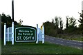
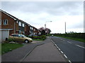
14 photos from this area
Area Information
Key information about the CO16 8PU including its size, population, and administrative classification.
- Area Type
- Postcode
- Area Size
- 8602 m²
- Population
- 1450
- Population Density
- 85 people/km²
House Prices in CO16 8PU
12
Properties
£196,500
Average Sold Price
£101,000
Lowest Price
£280,000
Highest Price
Showing 12 properties
| Address | Type | Beds | Baths | Last Sale Price | Last Sale Date | |
|---|---|---|---|---|---|---|
| 177 Clacton Road, St Osyth, CO16 8PU | Semi-detached | 3 | 1 | £280,000 | Dec 2022 | |
| 169 Clacton Road, St Osyth, CO16 8PU | Retail | 3 | 1 | £250,000 | Nov 2022 | |
| 161 Clacton Road, St Osyth, CO16 8PU | Semi-detached | 3 | 1 | £267,500 | Jul 2022 | |
| 155 Clacton Road, St Osyth, CO16 8PU | Detached | 3 | 1 | £240,000 | Jun 2018 | |
| 163 Clacton Road, St Osyth, CO16 8PU | Semi-detached | 3 | 1 | £223,000 | Aug 2017 | |
| 165 Clacton Road, St Osyth, CO16 8PU | Semi-detached | 3 | 1 | £142,500 | Jul 2014 | |
| 175 Clacton Road, St Osyth, CO16 8PU | house | - | - | £158,000 | Jan 2011 | |
| 173 Clacton Road, St Osyth, CO16 8PU | Detached | 3 | 1 | £160,000 | Dec 2006 | |
| 167 Clacton Road, St Osyth, CO16 8PU | Semi-detached | - | - | £143,000 | Jul 2004 | |
| 171 Clacton Road, St Osyth, CO16 8PU | Semi-detached | 3 | 1 | £101,000 | Jun 2002 |
Page 1 of 2
Energy Efficiency in CO16 8PU
Amenities
Schools
| Rank | School | Type | Entry gender | Ages |
|---|
Explore more schools in this area
Go to Schools tabDemographics
Household Size
Two person
most common
Accommodation Type
Houses
most common
Tenure
81
majority
Ethnic Group
White
most common
Religion
N/A
most common
Household Composition
N/A
most common
Age
47
median
Adults (30-64 years)
most common
Household Deprivation
N/A
with no deprivation
NS-SEC
27
in Lower managerial occupations
Explore more demographic insights in this area
Go to Demographics tabPlanning
Planning Constraints
- Flood RiskPremium
- Ramsar Wetland SitesPremium
- Area of Outstanding Natural BeautyPremium
- Protected Nature ReservePremium
- Protected WoodlandPremium