Area Overview for CO16 8JB
Photos of CO16 8JB
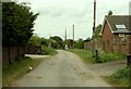
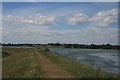
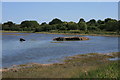
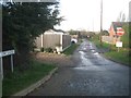
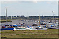
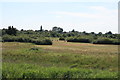
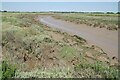
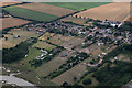
12 photos from this area
Area Information
Key information about the CO16 8JB including its size, population, and administrative classification.
- Area Type
- Postcode
- Area Size
- 5.9 hectares
- Population
- 1707
- Population Density
- 407 people/km²
House Prices in CO16 8JB
36
Properties
£315,941
Average Sold Price
£74,500
Lowest Price
£900,000
Highest Price
Showing 36 properties
| Address | Type | Beds | Baths | Last Sale Price | Last Sale Date | |
|---|---|---|---|---|---|---|
| 149 Point Clear Road, St Osyth, CO16 8JB | Semi-detached | 3 | 1 | £212,500 | Jan 2025 | |
| Fairview, 172A Point Clear Road, St Osyth, CO16 8JB | Detached | - | - | £392,500 | Nov 2023 | |
| 137 Point Clear Road, St Osyth, CO16 8JB | Bungalow | 3 | 1 | £350,000 | Oct 2022 | |
| 155 Point Clear Road, St Osyth, CO16 8JB | Bungalow | - | - | £350,000 | Jan 2022 | |
| 158 Point Clear Road, St Osyth, CO16 8JB | Bungalow | 2 | - | £312,500 | Jul 2020 | |
| 139 Point Clear Road, St Osyth, CO16 8JB | Bungalow | 1 | - | £160,000 | Dec 2018 | |
| 135 Point Clear Road, St Osyth, CO16 8JB | Bungalow | 3 | 1 | £295,000 | Jul 2018 | |
| 167 Point Clear Road, St Osyth, CO16 8JB | Semi-detached | 3 | 1 | £230,000 | Jul 2018 | |
| 160 Point Clear Road, St Osyth, CO16 8JB | Detached | 4 | 1 | £405,000 | Dec 2016 | |
| 145 Point Clear Road, St Osyth, CO16 8JB | Detached | 3 | 2 | £355,000 | Aug 2016 |
Page 1 of 4
Energy Efficiency in CO16 8JB
Amenities
Schools
| Rank | School | Type | Entry gender | Ages |
|---|
Explore more schools in this area
Go to Schools tabDemographics
Household Size
Two person
most common
Accommodation Type
Houses
most common
Tenure
82
majority
Ethnic Group
White
most common
Religion
N/A
most common
Household Composition
N/A
most common
Age
47
median
Adults (30-64 years)
most common
Household Deprivation
N/A
with no deprivation
NS-SEC
23
in Lower managerial occupations
Explore more demographic insights in this area
Go to Demographics tabPlanning
Planning Constraints
- Flood RiskPremium
- Ramsar Wetland SitesPremium
- Area of Outstanding Natural BeautyPremium
- Protected Nature ReservePremium
- Protected WoodlandPremium