Area Overview for CO16 8EW
Photos of CO16 8EW
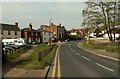
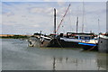
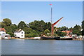

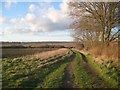
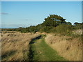


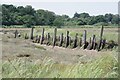
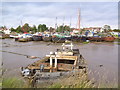
29 photos from this area
Area Information
Key information about the CO16 8EW including its size, population, and administrative classification.
- Area Type
- Postcode
- Area Size
- 10.0 hectares
- Population
- 1450
- Population Density
- 85 people/km²
House Prices in CO16 8EW
48
Properties
£316,250
Average Sold Price
£178,000
Lowest Price
£650,000
Highest Price
Showing 48 properties
| Address | Type | Beds | Baths | Last Sale Price | Last Sale Date | |
|---|---|---|---|---|---|---|
| 75 Mill Street, St Osyth, CO16 8EW | Terraced | 4 | 1 | £310,000 | Nov 2025 | |
| 89 Mill Street, St Osyth, CO16 8EW | Semi-detached | 2 | - | £187,000 | Nov 2022 | |
| 95 Mill Street, St Osyth, CO16 8EW | Detached | 4 | 2 | £375,000 | Feb 2022 | |
| 83 Mill Street, St Osyth, CO16 8EW | Detached | 5 | 2 | £375,000 | Mar 2021 | |
| 60 Mill Street, St Osyth, CO16 8EW | Detached | 2 | 2 | £650,000 | Sep 2019 | |
| 79 Mill Street, St Osyth, CO16 8EW | house | 3 | 1 | £220,000 | Mar 2017 | |
| 91 Mill Street, St Osyth, CO16 8EW | house | 2 | - | £178,000 | Dec 2005 | |
| 73 Mill Street, St Osyth, CO16 8EW | Terraced | - | - | £235,000 | Dec 2002 | |
| Houseboat Moran, St Osyth Boatyard, Mill Street, St Osyth, CO16 8EW | Detached | 2 | 1 | - | - | |
| 77 Mill Street, St Osyth, CO16 8EW | Terraced | 5 | 3 | - | - |
Page 1 of 5
Energy Efficiency in CO16 8EW
Amenities
Schools
| Rank | School | Type | Entry gender | Ages |
|---|
Explore more schools in this area
Go to Schools tabDemographics
Household Size
Two person
most common
Accommodation Type
Houses
most common
Tenure
81
majority
Ethnic Group
White
most common
Religion
N/A
most common
Household Composition
N/A
most common
Age
47
median
Adults (30-64 years)
most common
Household Deprivation
N/A
with no deprivation
NS-SEC
27
in Lower managerial occupations
Explore more demographic insights in this area
Go to Demographics tabPlanning
Planning Constraints
- Flood RiskPremium
- Ramsar Wetland SitesPremium
- Area of Outstanding Natural BeautyPremium
- Protected Nature ReservePremium
- Protected WoodlandPremium