Area Overview for CO16 8AQ
Photos of CO16 8AQ
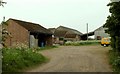
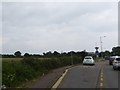
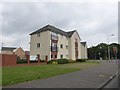
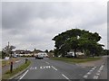
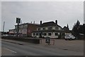
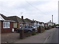

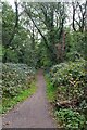
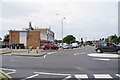

14 photos from this area
Area Information
Key information about the CO16 8AQ including its size, population, and administrative classification.
- Area Type
- Postcode
- Area Size
- 1.0 hectares
- Population
- 1518
- Population Density
- 7090 people/km²
House Prices in CO16 8AQ
15
Properties
£165,500
Average Sold Price
£83,000
Lowest Price
£235,000
Highest Price
Showing 15 properties
| Address | Type | Beds | Baths | Last Sale Price | Last Sale Date | |
|---|---|---|---|---|---|---|
| 259 Cloes Lane, Clacton On Sea, CO16 8AQ | Semi-detached | 3 | 1 | £182,000 | Jul 2021 | |
| 126 Cloes Lane, Clacton On Sea, CO16 8AQ | Bungalow | 4 | 2 | £235,000 | Aug 2020 | |
| 245 Cloes Lane, Clacton On Sea, CO16 8AQ | Semi-detached | 3 | 1 | £213,000 | Jan 2020 | |
| 128 Cloes Lane, Clacton On Sea, CO16 8AQ | Semi-detached | 3 | 1 | £150,000 | Mar 2015 | |
| 132 Cloes Lane, Clacton On Sea, CO16 8AQ | Bungalow | - | - | £130,000 | Jun 2002 | |
| 130 Cloes Lane, Clacton On Sea, CO16 8AQ | Detached | - | - | £83,000 | Jul 1999 | |
| 261 Cloes Lane, Clacton On Sea, CO16 8AQ | Semi-detached | 3 | 1 | - | - | |
| 134 Cloes Lane, Clacton On Sea, CO16 8AQ | Detached | - | - | - | - | |
| 251 Cloes Lane, Clacton On Sea, CO16 8AQ | Semi-detached | - | - | - | - | |
| 255 Cloes Lane, Clacton On Sea, CO16 8AQ | house | - | - | - | - |
Page 1 of 2
Energy Efficiency in CO16 8AQ
Amenities
Schools
| Rank | School | Type | Entry gender | Ages |
|---|
Explore more schools in this area
Go to Schools tabDemographics
Household Size
Family (3-5 people)
most common
Accommodation Type
Houses
most common
Tenure
66
majority
Ethnic Group
White
most common
Religion
N/A
most common
Household Composition
N/A
most common
Age
47
median
Adults (30-64 years)
most common
Household Deprivation
N/A
with no deprivation
NS-SEC
23
in Lower managerial occupations
Explore more demographic insights in this area
Go to Demographics tabPlanning
Planning Constraints
- Flood RiskPremium
- Ramsar Wetland SitesPremium
- Area of Outstanding Natural BeautyPremium
- Protected Nature ReservePremium
- Protected WoodlandPremium