Area Overview for CO16 8AH
Photos of CO16 8AH
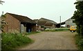
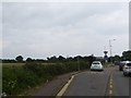
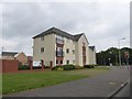
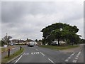
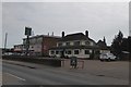
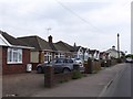

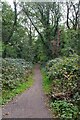
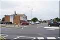

14 photos from this area
Area Information
Key information about the CO16 8AH including its size, population, and administrative classification.
- Area Type
- Postcode
- Area Size
- 5329 m²
- Population
- 1573
- Population Density
- 4290 people/km²
House Prices in CO16 8AH
15
Properties
£99,235
Average Sold Price
£32,600
Lowest Price
£135,000
Highest Price
Showing 15 properties
| Address | Type | Beds | Baths | Last Sale Price | Last Sale Date | |
|---|---|---|---|---|---|---|
| 14 Flatford Drive, Clacton On Sea, CO16 8AH | Maisonette | - | - | £116,000 | Mar 2017 | |
| 7 Flatford Drive, Clacton On Sea, CO16 8AH | house | 3 | 2 | £135,000 | Dec 2011 | |
| 18 Flatford Drive, Clacton On Sea, CO16 8AH | Flat | - | - | £105,000 | Jul 2006 | |
| 2 Flatford Drive, Clacton On Sea, CO16 8AH | Flat | 3 | 1 | £102,500 | May 2006 | |
| 9 Flatford Drive, Clacton On Sea, CO16 8AH | house | 3 | - | £133,250 | Dec 2004 | |
| 11 Flatford Drive, Clacton On Sea, CO16 8AH | house | - | - | £122,500 | Oct 2004 | |
| 5 Flatford Drive, Clacton On Sea, CO16 8AH | Semi-detached | 3 | 1 | £128,000 | Sep 2003 | |
| 3 Flatford Drive, Clacton On Sea, CO16 8AH | house | - | - | £59,500 | Nov 1999 | |
| 8 Flatford Drive, Clacton On Sea, CO16 8AH | Flat | - | - | £32,600 | Jul 1999 | |
| 1 Flatford Drive, Clacton On Sea, CO16 8AH | Semi-detached | - | - | £58,000 | Dec 1998 |
Page 1 of 2
Energy Efficiency in CO16 8AH
Amenities
Schools
| Rank | School | Type | Entry gender | Ages |
|---|
Explore more schools in this area
Go to Schools tabDemographics
Household Size
One person
most common
Accommodation Type
Houses
most common
Tenure
54
majority
Ethnic Group
White
most common
Religion
N/A
most common
Household Composition
N/A
most common
Age
47
median
Adults (30-64 years)
most common
Household Deprivation
N/A
with no deprivation
NS-SEC
17
in Lower managerial occupations
Explore more demographic insights in this area
Go to Demographics tabPlanning
Planning Constraints
- Flood RiskPremium
- Ramsar Wetland SitesPremium
- Area of Outstanding Natural BeautyPremium
- Protected Nature ReservePremium
- Protected WoodlandPremium