Area Overview for CO16 0EU
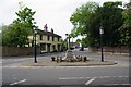
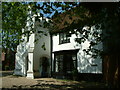
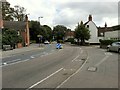
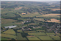
Photos of CO16 0EU
Area Information
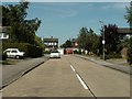
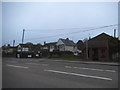
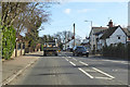
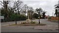
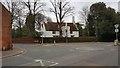
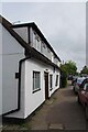
Living in Thorpe-le-Soken offers a tranquil connection to deep history within a compact residential cluster. This specific postcode covers an area of just 2,923 square metres, hosting a population of 1,272 people. The density here sits at approximately 270 people per square kilometre, reflecting a deliberate choice for low-density living. Residents enjoy a sense of privacy while remaining accessible via the established Tendring district infrastructure. The village forms part of the historical Soken area, a jurisdiction with a distinct heritage dating back to Saxon times. Archaeological evidence places settlements here thousands of years ago, yet the modern community retains the character of the civil parish established over a millennium ago. St Michael's Church and the Grade II* listed Thorpe Hall serve as tangible links to this continuity. You will find that daily life centres around the High Street, medieval settlement remnants, and the designated Thorpe-le-Soken Station and Maltings Conservation Area. The village provides a quiet environment where the rhythm of life is set by local events rather than fast-paced urban demands. This setting suits those seeking a backdrop of historical depth without the chaos of larger towns. The specific layout of this small residential cluster ensures that your view often encompasses greenery or historic architecture rather than neighbouring brick walls.
- Area Type
- Postcode
- Area Size
- 2923 m²
- Population
- 1272
- Population Density
- 270 people/km²
The property market in CO16 0EU is overwhelmingly characterised by ownership. With 94% of homes owned by residents, this indicates a community where buyers rather than renters dominate the housing landscape. Houses form the singular predominant accommodation type throughout this postcode sector. This high rate of ownership implies that most properties have been established for significant periods, contributing to their current value and condition. You are looking at a market where speculative buying is less common than permanent settlement. The small footprint of 2,923 square metres means there is limited inventory within this exact grid, so serious buyers often cast their nets into adjacent villages within the Soken jurisdiction. Potential purchasers should expect to find a consistent mix of styles suitable for nuclear families, given the age profile of the occupants. The area sits away from the rapid turnover often seen in commuter towns with high student or young professional populations. Instead, listings here tend to be held longer by existing owners who rarely sell. This stability can be an advantage for those seeking a predictable investment or a family home that will serve multiple generations.
House Prices in CO16 0EU
Showing 4 properties
| Address | Type | Beds | Baths | Last Sale Price | Last Sale Date | |
|---|---|---|---|---|---|---|
| 8 Paolozzi Way, Thorpe Le Soken, CO16 0EU | house | - | - | £327,995 | Aug 2021 | |
| 2 Paolozzi Way, Thorpe Le Soken, CO16 0EU | house | - | - | £397,995 | Aug 2021 | |
| 6 Paolozzi Way, Thorpe Le Soken, CO16 0EU | house | - | - | - | - | |
| 4 Paolozzi Way, Thorpe Le Soken, CO16 0EU | house | - | - | - | - |
Energy Efficiency in CO16 0EU
Daily life in CO16 0EU revolves around a cluster of practical amenities reachable within a short drive or walk. Residents have access to five retail outlets, including Tesco Thorpe, Tesco Kirby, and M&S Clacton. These specific locations allow you to handle most weekly shopping needs without travelling far. Transport links are equally accessible, with five rail stations in the immediate vicinity. You can reach Thorpe, Kirby Cross Railway Station, and Weeley Railway Station quickly depending on your destination. The village itself offers the unique advantage of living near the Thorpe-le-Soken Station and Maltings Conservation Area, a site designated in 1990 for its heritage value. Walking along the High Street, which features medieval settlement remnants, provides a link to history. While specific parks or leisure centres are not named in the data, the presence of St Michael's Church and Thorpe Hall indicates green spaces and cultural interest. The area supports a lifestyle where convenience meets historical preservation. Your evening routine might involve a stroll near the manor house or using the nearby railway station for a weekend trip.
Amenities
Schools
| Rank | School | Type | Entry gender | Ages |
|---|
Explore more schools in this area
Go to Schools tabDemographics
The community in CO16 0EU is defined by stability and maturity. By far the most common age range among inhabitants consists of adults between 30 and 64 years. This demographic profile indicates that the village attracts families in their prime working years and individuals building long-term roots. The median age of 47 years confirms that this is not a retirement estate nor a hub for young professionals or students. Instead, it appeals to established households who value a permanent home. Home ownership stands at an impressive level of 94%, meaning that the vast majority of houses in Thorpe-le-Soken are owned outright by their occupants. This high percentage suggests low tenant turnover and a resident population invested in the local schools and services. Houses form the primary accommodation type, reinforcing the domestic nature of the settlement. The area is predominantly White, reflecting the traditional demographic composition of much of Essex. There are no specific statistics on deprivation provided in the local data for this cluster, so your assessment of cost of living should rely on regional trends for Tendring. The social fabric is woven around long-term neighbours who share a direct stake in the upkeep of properties like Thorpe Hall and the village greens.
Household Size
Accommodation Type
Tenure
Ethnic Group
Religion
Household Composition
Age
Household Deprivation
NS-SEC
Explore more demographic insights in this area
Go to Demographics tabPlanning
Planning Constraints
- Flood RiskPremium
- Ramsar Wetland SitesPremium
- Area of Outstanding Natural BeautyPremium
- Protected Nature ReservePremium
- Protected WoodlandPremium