Area Overview for CO13 9NU
Photos of CO13 9NU
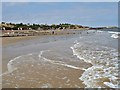
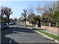
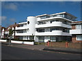
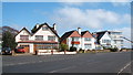
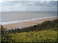
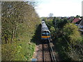
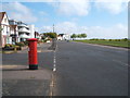
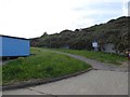
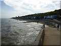
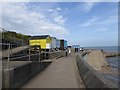
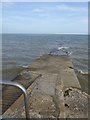
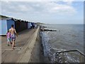
55 photos from this area
Area Information
Key information about the CO13 9NU including its size, population, and administrative classification.
- Area Type
- Postcode
- Area Size
- 4.1 hectares
- Population
- 1351
- Population Density
- 3155 people/km²
House Prices in CO13 9NU
40
Properties
£297,852
Average Sold Price
£59,750
Lowest Price
£730,000
Highest Price
Showing 40 properties
| Address | Type | Beds | Baths | Last Sale Price | Last Sale Date | |
|---|---|---|---|---|---|---|
| 33 Easton Way, Frinton On Sea, CO13 9NU | Semi-detached | 2 | 1 | £255,000 | Nov 2025 | |
| 29 Easton Way, Frinton On Sea, CO13 9NU | Chalet | 4 | 2 | £449,950 | Jun 2025 | |
| 36 Easton Way, Frinton On Sea, CO13 9NU | Semi-detached | 3 | 1 | £260,000 | Mar 2025 | |
| 27 Easton Way, Frinton On Sea, CO13 9NU | Bungalow | 2 | 1 | £369,000 | Oct 2024 | |
| 4 Easton Way, Frinton On Sea, CO13 9NU | Detached | 4 | 1 | £650,000 | Jun 2022 | |
| Manderley, Easton Way, Frinton On Sea, CO13 9NU | Bungalow | - | - | £715,000 | May 2022 | |
| Sea House, Easton Way, Frinton On Sea, CO13 9NU | Detached | 4 | 2 | £585,000 | Apr 2021 | |
| 41 Easton Way, Frinton On Sea, CO13 9NU | Bungalow | - | - | £208,000 | Nov 2020 | |
| 30 Easton Way, Frinton On Sea, CO13 9NU | Semi-detached | 2 | - | £325,000 | Aug 2020 | |
| 17 Easton Way, Frinton On Sea, CO13 9NU | house | - | - | £410,000 | Jul 2017 |
Page 1 of 4
Energy Efficiency in CO13 9NU
Amenities
Schools
| Rank | School | Type | Entry gender | Ages |
|---|
Explore more schools in this area
Go to Schools tabDemographics
Household Size
Two person
most common
Accommodation Type
Houses
most common
Tenure
76
majority
Ethnic Group
White
most common
Religion
N/A
most common
Household Composition
N/A
most common
Age
47
median
Elderly (65+ years)
most common
Household Deprivation
N/A
with no deprivation
NS-SEC
35
in Lower managerial occupations
Explore more demographic insights in this area
Go to Demographics tabPlanning
Planning Constraints
- Flood RiskPremium
- Ramsar Wetland SitesPremium
- Area of Outstanding Natural BeautyPremium
- Protected Nature ReservePremium
- Protected WoodlandPremium