Area Overview for CO13 9NS
Photos of CO13 9NS
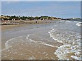
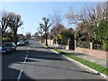
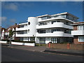
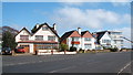
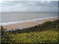
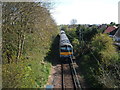
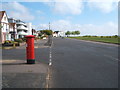
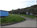
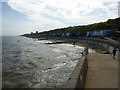
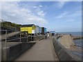
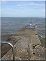
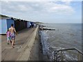
55 photos from this area
Area Information
Key information about the CO13 9NS including its size, population, and administrative classification.
- Area Type
- Postcode
- Area Size
- 1.1 hectares
- Population
- 1351
- Population Density
- 3155 people/km²
House Prices in CO13 9NS
30
Properties
£191,092
Average Sold Price
£46,000
Lowest Price
£435,000
Highest Price
Showing 30 properties
| Address | Type | Beds | Baths | Last Sale Price | Last Sale Date | |
|---|---|---|---|---|---|---|
| 30 Rainham Way, Frinton On Sea, CO13 9NS | Bungalow | 2 | 1 | £250,000 | Nov 2024 | |
| 16 Rainham Way, Frinton On Sea, CO13 9NS | Bungalow | - | - | £335,000 | Jul 2024 | |
| 18 Rainham Way, Frinton On Sea, CO13 9NS | Retail | 2 | 1 | £270,000 | Jun 2022 | |
| 12 Rainham Way, Frinton On Sea, CO13 9NS | Bungalow | 2 | 1 | £370,000 | May 2021 | |
| 52 Rainham Way, Frinton On Sea, CO13 9NS | Semi-detached | 2 | 1 | £225,000 | Feb 2021 | |
| 50 Rainham Way, Frinton On Sea, CO13 9NS | Semi-detached | 2 | 1 | £230,500 | Dec 2020 | |
| 40 Rainham Way, Frinton On Sea, CO13 9NS | Bungalow | - | - | £205,000 | Sep 2020 | |
| 36 Rainham Way, Frinton On Sea, CO13 9NS | Semi-detached | 2 | 1 | £210,000 | Jun 2020 | |
| 48 Rainham Way, Frinton On Sea, CO13 9NS | Semi-detached | 2 | 1 | £250,000 | Jul 2018 | |
| 58 Rainham Way, Frinton On Sea, CO13 9NS | Bungalow | 3 | 1 | £435,000 | Feb 2018 |
Page 1 of 3
Energy Efficiency in CO13 9NS
Amenities
Schools
| Rank | School | Type | Entry gender | Ages |
|---|
Explore more schools in this area
Go to Schools tabDemographics
Household Size
Two person
most common
Accommodation Type
Houses
most common
Tenure
76
majority
Ethnic Group
White
most common
Religion
N/A
most common
Household Composition
N/A
most common
Age
47
median
Elderly (65+ years)
most common
Household Deprivation
N/A
with no deprivation
NS-SEC
35
in Lower managerial occupations
Explore more demographic insights in this area
Go to Demographics tabPlanning
Planning Constraints
- Flood RiskPremium
- Ramsar Wetland SitesPremium
- Area of Outstanding Natural BeautyPremium
- Protected Nature ReservePremium
- Protected WoodlandPremium