Area Overview for CO13 0TE
Photos of CO13 0TE

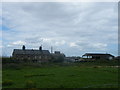
11 photos from this area
Area Information
Key information about the CO13 0TE including its size, population, and administrative classification.
- Area Type
- Postcode
- Area Size
- 3745 m²
- Population
- 1309
- Population Density
- 2442 people/km²
House Prices in CO13 0TE
4
Properties
£175,000
Average Sold Price
£150,000
Lowest Price
£190,000
Highest Price
Showing 4 properties
| Address | Type | Beds | Baths | Last Sale Price | Last Sale Date | |
|---|---|---|---|---|---|---|
| 2 Haslemere Gardens, Kirby Cross, CO13 0TE | Bungalow | - | - | £190,000 | Jan 2014 | |
| 8 Haslemere Gardens, Kirby Cross, CO13 0TE | Bungalow | - | - | £185,000 | Jan 2009 | |
| 4 Haslemere Gardens, Kirby Cross, CO13 0TE | Detached | - | - | £150,000 | Apr 2001 | |
| 6 Haslemere Gardens, Kirby Cross, CO13 0TE | Detached | 3 | 2 | - | - |
Energy Efficiency in CO13 0TE
Amenities
Schools
| Rank | School | Type | Entry gender | Ages |
|---|
Explore more schools in this area
Go to Schools tabDemographics
Household Size
Two person
most common
Accommodation Type
Houses
most common
Tenure
79
majority
Ethnic Group
White
most common
Religion
N/A
most common
Household Composition
N/A
most common
Age
47
median
Elderly (65+ years)
most common
Household Deprivation
N/A
with no deprivation
NS-SEC
29
in Lower managerial occupations
Explore more demographic insights in this area
Go to Demographics tabPlanning
Planning Constraints
- Flood RiskPremium
- Ramsar Wetland SitesPremium
- Area of Outstanding Natural BeautyPremium
- Protected Nature ReservePremium
- Protected WoodlandPremium