Area Overview for CO12 3LS
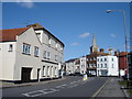
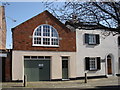
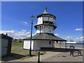
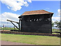
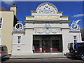
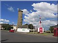
Photos of CO12 3LS


Area Information
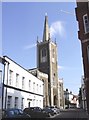
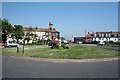
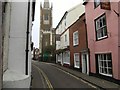
Living in CO12 3LS means residing within a small residential cluster in the civil parish of Harwich. This specific postcode covers just 7,775 square metres of land, home to exactly 1,456 people. The density reaches 187,265 people per square kilometre, reflecting a tightly packed urban environment rather than a sprawling suburb. Harwich itself is a historic port town in Tendring, Essex, situated at the mouth of the River Stour. The town operates under three tiers of local government, including Harwich Town Council, and its economy has long been centred on maritime activities and commercial shipping. You will find yourself near notable landmarks such as the Harwich Guildhall, a Grade I listed building from 1769, and the parish church of St. Nicholas, constructed in a restrained Gothic style. The area carries deep history, from receiving its borough charter in 1318 to its role in the events of 1688. While the immediate neighbourhood is compact, the broader context offers a rich connection to maritime heritage and trade.
- Area Type
- Postcode
- Area Size
- 7775 m²
- Population
- 1456
- Population Density
- 2709 people/km²
The property market in CO12 3LS is characterised by a clear preference for traditional housing stock. Houses remain the dominant accommodation type for homes in this postcode, meaning you will not typically find high-rise flats or modern apartments as the primary housing unit. With 55% of the area showing home ownership, this is an owner-occupied neighbourhood rather than a high-rental-density zone like some coastal or student hubs. This ownership figure implies that many properties have stabilised values driven by local demand rather than speculative rental yields. When looking at homes in CO12 3LS, you are dealing with a market where long-term residents hold a majority stake. The small area size of just 7,775 square metres further restricts land availability, meaning competition for suitable housing likely remains steady. Buyers should expect a market where existing homeowners have significant leverage. The dominance of houses also suggests a family-oriented stock, appealing to those seeking permanent residences rather than temporary lets.
House Prices in CO12 3LS
Showing 14 properties
| Address | Type | Beds | Baths | Last Sale Price | Last Sale Date | |
|---|---|---|---|---|---|---|
| 31 Main Road, Harwich, CO12 3LS | Terraced | 3 | 1 | £250,000 | Nov 2024 | |
| 33 Main Road, Harwich, CO12 3LS | Terraced | 3 | 1 | £180,000 | Feb 2024 | |
| 39 Main Road, Harwich, CO12 3LS | house | - | - | £230,000 | Jun 2020 | |
| 51 Main Road, Harwich, CO12 3LS | Terraced | - | - | £140,000 | May 2006 | |
| 47 Main Road, Harwich, CO12 3LS | Terraced | 3 | 1 | £129,995 | Apr 2006 | |
| 41 Main Road, Harwich, CO12 3LS | Semi-detached | - | - | £136,000 | Dec 2005 | |
| 43 Main Road, Harwich, CO12 3LS | Terraced | - | - | - | - | |
| 53 Main Road, Harwich, CO12 3LS | Terraced | - | - | - | - | |
| 35 Main Road, Harwich, CO12 3LS | Terraced | - | - | - | - | |
| 37 Main Road, Harwich, CO12 3LS | house | - | - | - | - |
Energy Efficiency in CO12 3LS
Daily life in CO12 3LS benefits from a range of amenities located within practical reach of your doorstep. Retail options are diverse, with Iceland Dovercourt, East of England Co-operative Co, and Asda Harwich all nearby. These supermarkets ensure you can shop for groceries and essentials without travelling far. For leisure or social trips, the coastline offers distinct attractions. You have access to Harwich Harbour Ferry Landing and Shotley Point Marina Ferry Landing for boat trips or scenic cruises. Transport links to these attractions are immediate, given the presence of five nearby train stations. The character of this lifestyle is defined by a mix of convenient local shopping and rich coastal recreation. You do not need to venture far to find essential services or enjoy the maritime atmosphere. The specific venues listed mean your weekly routine can easily incorporate both practical errands and leisure activities without significant travel time.
Amenities
Schools
Educational provision for families living in CO12 3LS is well-supported by local institutions. The nearest school you need to consider is Harwich Community Primary School and Nursery. This facility operates as a primary school and has achieved a Good rating from Ofsted. A Good rating indicates that the school meets National Curriculum standards effectively and provides a positive learning environment for its pupils. For parents looking at schools near CO12 3LS, this specific venue offers a proven record of educational success. The strong Ofsted standing suggests reliable educational outcomes, which is a primary concern for families choosing where to live. While the data highlights only this single primary option, its quality makes it a central feature of the local education landscape. You can look to this school as a key asset for any property decision within this immediate residential cluster.
| Rank | School | Type | Entry gender | Ages |
|---|
Explore more schools in this area
Go to Schools tabDemographics
The community in CO12 3LS reflects an established population with a median age of 47 years. Adults aged between 30 and 64 years represent the most common age range, suggesting a neighbourhood settled by families and long-term residents. Home ownership is significant, with 55% of the population owning their properties outright or with a mortgage. The remaining households are composed of social or private rentals, though the data highlights houses as the predominant accommodation type. The ethnic composition tells you that the White group is the predominant demographic living here. This profile indicates a stable community where many people have put down roots. The high proportion of homeowners often suggests a lower level of transient movement compared to pure rental markets. For those considering moving here, you will join a community where a majority of neighbours likely have lived in their homes for considerable periods.
Household Size
Accommodation Type
Tenure
Ethnic Group
Religion
Household Composition
Age
Household Deprivation
NS-SEC
Explore more demographic insights in this area
Go to Demographics tabPlanning
Planning Constraints
- Flood RiskPremium
- Ramsar Wetland SitesPremium
- Area of Outstanding Natural BeautyPremium
- Protected Nature ReservePremium
- Protected WoodlandPremium