Area Overview for CO10 9SA
Photos of CO10 9SA
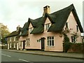
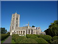
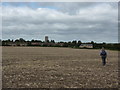
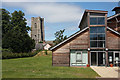
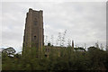
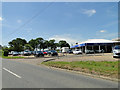
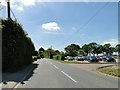
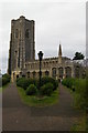
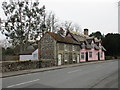
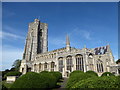
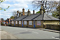
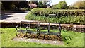
52 photos from this area
Area Information
Key information about the CO10 9SA including its size, population, and administrative classification.
- Area Type
- Postcode
- Area Size
- 2.2 hectares
- Population
- 1922
- Population Density
- 160 people/km²
House Prices in CO10 9SA
12
Properties
£871,667
Average Sold Price
£215,000
Lowest Price
£1,800,000
Highest Price
Showing 12 properties
| Address | Type | Beds | Baths | Last Sale Price | Last Sale Date | |
|---|---|---|---|---|---|---|
| Church Cottage, 45-46 Church Street, Lavenham, CO10 9SA | Cottage | 4 | 2 | £600,000 | Jul 2025 | |
| The Old Rectory, Church Street, Lavenham, CO10 9SA | Detached | 8 | 7 | £1,800,000 | Jul 2014 | |
| Glebe Cottage, 44 Church Street, Lavenham, CO10 9SA | Semi-detached | - | - | £215,000 | May 2007 | |
| Annexe Accommodation At, The Old Rectory, Church Street, Lavenham, CO10 9SA | Detached | 5 | - | - | - | |
| 40 Church Street, Lavenham, CO10 9SA | Bungalow | - | - | - | - | |
| 42 Church Street, Lavenham, CO10 9SA | Bungalow | - | - | - | - | |
| 39 Church Street, Lavenham, CO10 9SA | Bungalow | - | - | - | - | |
| 41 Church Street, Lavenham, CO10 9SA | Bungalow | - | - | - | - | |
| 43 Church Street, Lavenham, CO10 9SA | Bungalow | - | - | - | - | |
| 38 Church Street, Lavenham, CO10 9SA | Bungalow | - | - | - | - |
Page 1 of 2
Energy Efficiency in CO10 9SA
Amenities
Schools
| Rank | School | Type | Entry gender | Ages |
|---|
Explore more schools in this area
Go to Schools tabDemographics
Household Size
One person
most common
Accommodation Type
Houses
most common
Tenure
65
majority
Ethnic Group
White
most common
Religion
N/A
most common
Household Composition
N/A
most common
Age
47
median
Adults (30-64 years)
most common
Household Deprivation
N/A
with no deprivation
NS-SEC
38
in Lower managerial occupations
Explore more demographic insights in this area
Go to Demographics tabPlanning
Planning Constraints
- Flood RiskPremium
- Ramsar Wetland SitesPremium
- Area of Outstanding Natural BeautyPremium
- Protected Nature ReservePremium
- Protected WoodlandPremium