Area Overview for CO10 1QT
Photos of CO10 1QT
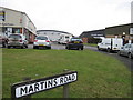
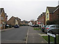
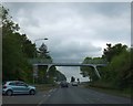
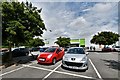
14 photos from this area
Area Information
Key information about the CO10 1QT including its size, population, and administrative classification.
- Area Type
- Postcode
- Area Size
- 2.5 hectares
- Population
- Not available
- Population Density
- Not available
House Prices in CO10 1QT
63
Properties
£119,710
Average Sold Price
£24,420
Lowest Price
£220,000
Highest Price
Showing 63 properties
| Address | Type | Beds | Baths | Last Sale Price | Last Sale Date | |
|---|---|---|---|---|---|---|
| 4 First Avenue, Sudbury, CO10 1QT | Terraced | 3 | 1 | £220,000 | Jan 2024 | |
| 58 First Avenue, Sudbury, CO10 1QT | Terraced | 2 | 1 | £215,000 | Aug 2023 | |
| 2 First Avenue, Sudbury, CO10 1QT | house | - | - | £200,000 | Mar 2023 | |
| 16 First Avenue, Sudbury, CO10 1QT | Terraced | 3 | 1 | £205,000 | Sep 2022 | |
| 62 First Avenue, Sudbury, CO10 1QT | Semi-detached | 3 | - | £212,000 | Dec 2021 | |
| 24 First Avenue, Sudbury, CO10 1QT | Terraced | 3 | 1 | £163,000 | Jul 2019 | |
| 26 First Avenue, Sudbury, CO10 1QT | Semi-detached | 3 | - | £128,000 | Nov 2013 | |
| 6 First Avenue, Sudbury, CO10 1QT | house | - | - | £110,000 | Oct 2012 | |
| 48 First Avenue, Sudbury, CO10 1QT | house | - | - | £115,000 | Jan 2012 | |
| 104 First Avenue, Sudbury, CO10 1QT | house | 3 | - | £94,500 | Jun 2011 |
Page 1 of 7
Energy Efficiency in CO10 1QT
Amenities
Schools
| Rank | School | Type | Entry gender | Ages |
|---|
Explore more schools in this area
Go to Schools tabDemographics
Household Size
Two person
most common
Accommodation Type
Houses
most common
Tenure
53
majority
Ethnic Group
White
most common
Religion
N/A
most common
Household Composition
N/A
most common
Age
47
median
Adults (30-64 years)
most common
Household Deprivation
N/A
with no deprivation
NS-SEC
24
in Lower managerial occupations
Explore more demographic insights in this area
Go to Demographics tabPlanning
Planning Constraints
- Flood RiskPremium
- Ramsar Wetland SitesPremium
- Area of Outstanding Natural BeautyPremium
- Protected Nature ReservePremium
- Protected WoodlandPremium