Area Overview for CM9 6HP
Photos of CM9 6HP
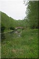
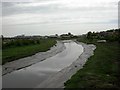
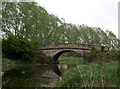
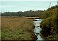
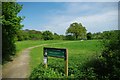
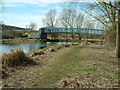
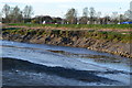
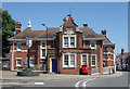
100 photos from this area
Area Information
Key information about the CM9 6HP including its size, population, and administrative classification.
- Area Type
- Postcode
- Area Size
- 6.3 hectares
- Population
- 1082
- Population Density
- 372 people/km²
House Prices in CM9 6HP
9
Properties
£586,000
Average Sold Price
£380,000
Lowest Price
£965,000
Highest Price
Showing 9 properties
| Address | Type | Beds | Baths | Last Sale Price | Last Sale Date | |
|---|---|---|---|---|---|---|
| New Lodge, Dykes Chase, Maldon, CM9 6HP | Bungalow | - | - | £965,000 | Oct 2022 | |
| 7 Dykes Chase, Maldon, CM9 6HP | house | - | - | £420,000 | Feb 2021 | |
| Prospect, Dykes Chase, Maldon, CM9 6HP | Detached | 4 | 3 | £613,000 | Mar 2020 | |
| 1 Dykes Chase, Maldon, CM9 6HP | Detached | 3 | - | £640,000 | Jul 2019 | |
| Thannets, 9 Dykes Chase, Maldon, CM9 6HP | Detached | 4 | 2 | £498,000 | Jan 2019 | |
| Horama, Dykes Chase, Maldon, CM9 6HP | Detached | - | - | £380,000 | Apr 2006 | |
| New Dwelling Adjacent New Lodge, Dykes Chase, Maldon, CM9 6HP | Detached | - | - | - | - | |
| Hillyfield, Dykes Chase, Maldon, CM9 6HP | Detached | - | - | - | - | |
| Trelawney, 3 Dykes Chase, Maldon, CM9 6HP | Detached | - | - | - | - |
Energy Efficiency in CM9 6HP
Amenities
Schools
| Rank | School | Type | Entry gender | Ages |
|---|
Explore more schools in this area
Go to Schools tabDemographics
Household Size
One person
most common
Accommodation Type
Houses
most common
Tenure
56
majority
Ethnic Group
White
most common
Religion
N/A
most common
Household Composition
N/A
most common
Age
47
median
Adults (30-64 years)
most common
Household Deprivation
N/A
with no deprivation
NS-SEC
28
in Lower managerial occupations
Explore more demographic insights in this area
Go to Demographics tabPlanning
Planning Constraints
- Flood RiskPremium
- Ramsar Wetland SitesPremium
- Area of Outstanding Natural BeautyPremium
- Protected Nature ReservePremium
- Protected WoodlandPremium