Area Overview for CM9 5EN
Photos of CM9 5EN


Area Information
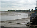
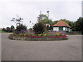
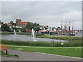
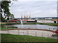
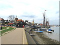
CM9 5EN is a small residential cluster in Essex, nestled on the south bank of the Blackwater Estuary. With a population of 1,809 spread across 1.3 hectares, it is one of the most densely populated areas in England, at 142,617 people per square kilometre. This postcode falls within Maldon, a historic market town with Saxon origins, known for its role as a regional trade centre. Daily life here is shaped by its compact size and proximity to key amenities. Residents benefit from nearby railway stations, including Hatfield Peverel, Witham, and North Fambridge, which provide connections to larger towns. The area’s compact nature means most essentials are within walking or cycling distance, though its small footprint means property options are limited to a handful of homes. Maldon’s heritage as a former port and its medieval churches, like St Peter’s Tower, add a layer of historical character to the modern residential landscape. For those seeking a mix of historic charm and practical living, CM9 5EN offers a unique blend of density and accessibility.
- Area Type
- Postcode
- Area Size
- 1.3 hectares
- Population
- Not available
- Population Density
- Not available
The property market in CM9 5EN is characterised by a 54% home ownership rate, with houses forming the predominant accommodation type. This suggests a mix of owner-occupied and rental properties, though the exact proportion of rentals is not specified. Given the area’s small size—just 1.3 hectares—housing stock is limited, and properties are likely to be tightly clustered. The high population density implies that homes are closely spaced, which may appeal to buyers seeking compact living but could pose challenges for those desiring larger spaces. The focus on houses rather than flats or apartments indicates a preference for traditional, family-friendly housing. Buyers should consider nearby areas for more extensive options, as CM9 5EN’s immediate surroundings may offer additional properties. The market’s stability is reflected in the moderate home ownership rate, though competition for available homes is likely to be intense due to the area’s small footprint.
House Prices in CM9 5EN
Showing 43 properties
| Address | Type | Beds | Baths | Last Sale Price | Last Sale Date | |
|---|---|---|---|---|---|---|
| 11 Tenterfield Road, Maldon, CM9 5EN | Terraced | 2 | 1 | £310,000 | Aug 2025 | |
| 17 Tenterfield Road, Maldon, CM9 5EN | house | 2 | 1 | £255,000 | Dec 2024 | |
| 53 Tenterfield Road, Maldon, CM9 5EN | Detached | 3 | 1 | £560,000 | Mar 2023 | |
| 73 Tenterfield Road, Maldon, CM9 5EN | house | 2 | 1 | £250,000 | Mar 2022 | |
| 61 Tenterfield Road, Maldon, CM9 5EN | house | 3 | - | £370,000 | Mar 2022 | |
| 9 Tenterfield Road, Maldon, CM9 5EN | house | - | - | £282,500 | Jan 2022 | |
| 35 Tenterfield Road, Maldon, CM9 5EN | house | - | - | £292,000 | Sep 2021 | |
| 47 Tenterfield Road, Maldon, CM9 5EN | Terraced | 2 | 1 | £260,000 | Nov 2020 | |
| 5 Tenterfield Road, Maldon, CM9 5EN | Terraced | 2 | 1 | £270,000 | Dec 2019 | |
| 31 Tenterfield Road, Maldon, CM9 5EN | Detached | 3 | - | £442,000 | May 2019 |
Energy Efficiency in CM9 5EN
Residents of CM9 5EN have access to a range of local amenities within practical reach. Retail options include Iceland Maldon, M&S Maldon SF, and Lidl Heybridge, providing grocery and general shopping needs. The nearby railway stations—Hatfield Peverel, Witham, and North Fambridge—offer direct links to larger towns, enhancing connectivity for commuting or leisure. While the area’s compact size limits larger parks or recreational spaces, its proximity to Maldon’s historic centres and the Blackwater Estuary may offer opportunities for walking or cycling. The presence of retail and transport hubs suggests a convenient lifestyle, though the lack of detailed data on leisure facilities means residents may need to travel slightly further for cultural or recreational activities. The combination of shops, transport, and historical context creates a practical yet characterful environment for daily living.
Amenities
Schools
| Rank | School | Type | Entry gender | Ages |
|---|
Explore more schools in this area
Go to Schools tabDemographics
The community in CM9 5EN is predominantly middle-aged, with a median age of 47 and the majority of residents falling into the 30-64 age range. Home ownership is relatively high at 54%, suggesting a stable, long-term population. The area is primarily composed of houses, reflecting a preference for family-oriented or semi-detached living. The predominant ethnic group is White, though specific diversity metrics are not provided. The high population density—142,617 people per square kilometre—means the area is among the most crowded in England, which can impact local services and infrastructure. While the data does not include deprivation statistics, the combination of high density and limited space may influence quality of life factors such as green space availability and community cohesion. This demographic profile indicates a mature, settled population with established ties to the area.
Household Size
Accommodation Type
Tenure
Ethnic Group
Religion
Household Composition
Age
Household Deprivation
NS-SEC
Explore more demographic insights in this area
Go to Demographics tabPlanning
Planning Constraints
- Flood RiskPremium
- Ramsar Wetland SitesPremium
- Area of Outstanding Natural BeautyPremium
- Protected Nature ReservePremium
- Protected WoodlandPremium