Area Overview for CM5 9BN
Photos of CM5 9BN
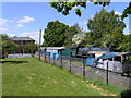
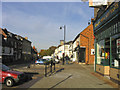
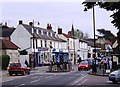

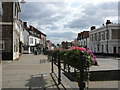
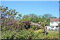
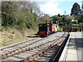

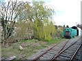
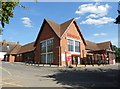
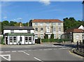
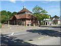
100 photos from this area
Area Information
Key information about the CM5 9BN including its size, population, and administrative classification.
- Area Type
- Postcode
- Area Size
- 7473 m²
- Population
- 1204
- Population Density
- 1240 people/km²
House Prices in CM5 9BN
12
Properties
£288,492
Average Sold Price
£88,000
Lowest Price
£465,000
Highest Price
Showing 12 properties
| Address | Type | Beds | Baths | Last Sale Price | Last Sale Date | |
|---|---|---|---|---|---|---|
| Braemar, High Street, Ongar, CM5 9BN | Semi-detached | 4 | 1 | £465,000 | Nov 2019 | |
| Rosemead, High Street, Ongar, CM5 9BN | Semi-detached | 3 | 1 | £385,000 | Aug 2017 | |
| Fairway, High Street, Ongar, CM5 9BN | Terraced | 5 | 3 | £374,950 | Nov 2015 | |
| Gloriette, High Street, Ongar, CM5 9BN | Semi-detached | 3 | 1 | £290,000 | Mar 2014 | |
| Rivendell, High Street, Ongar, CM5 9BN | Semi-detached | - | - | £128,000 | Oct 1999 | |
| Foxhall, High Street, Ongar, CM5 9BN | Semi-detached | - | - | £88,000 | Jul 1996 | |
| The Old Station Masters Office Ongar Car Services Ltd, High Street, Ongar, CM5 9BN | Office | - | - | - | - | |
| Threeways, High Street, Ongar, CM5 9BN | Semi-detached | - | - | - | - | |
| Theydon Nursery, High Street, Ongar, CM5 9BN | commercial | - | - | - | - | |
| Michael Connolly Antiques, High Street, Ongar, CM5 9BN | shop | - | - | - | - |
Page 1 of 2
Energy Efficiency in CM5 9BN
Amenities
Schools
| Rank | School | Type | Entry gender | Ages |
|---|
Explore more schools in this area
Go to Schools tabDemographics
Household Size
Two person
most common
Accommodation Type
Houses
most common
Tenure
91
majority
Ethnic Group
White
most common
Religion
N/A
most common
Household Composition
N/A
most common
Age
47
median
Adults (30-64 years)
most common
Household Deprivation
N/A
with no deprivation
NS-SEC
38
in Lower managerial occupations
Explore more demographic insights in this area
Go to Demographics tabPlanning
Planning Constraints
- Flood RiskPremium
- Ramsar Wetland SitesPremium
- Area of Outstanding Natural BeautyPremium
- Protected Nature ReservePremium
- Protected WoodlandPremium