Area Overview for CM5 9AU
Photos of CM5 9AU
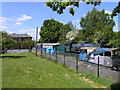
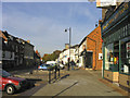
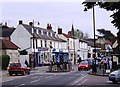
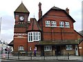
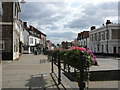

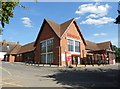
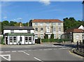
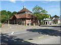
100 photos from this area
Area Information
Key information about the CM5 9AU including its size, population, and administrative classification.
- Area Type
- Postcode
- Area Size
- 1.6 hectares
- Population
- 1204
- Population Density
- 1240 people/km²
House Prices in CM5 9AU
36
Properties
£357,138
Average Sold Price
£83,000
Lowest Price
£545,000
Highest Price
Showing 36 properties
| Address | Type | Beds | Baths | Last Sale Price | Last Sale Date | |
|---|---|---|---|---|---|---|
| 9 Bowes Drive, Ongar, CM5 9AU | Detached | 5 | 2 | £545,000 | Aug 2025 | |
| 39 Bowes Drive, Ongar, CM5 9AU | Bungalow | 2 | 1 | £475,000 | Jan 2025 | |
| 24 Bowes Drive, Ongar, CM5 9AU | Semi-detached | 3 | 1 | £510,000 | Aug 2024 | |
| 7 Bowes Drive, Ongar, CM5 9AU | Semi-detached | 5 | 1 | £457,000 | Nov 2023 | |
| 16 Bowes Drive, Ongar, CM5 9AU | Detached | 3 | 2 | £520,000 | Oct 2023 | |
| 37 Bowes Drive, Ongar, CM5 9AU | Bungalow | 2 | 1 | £430,000 | Sep 2023 | |
| 26 Bowes Drive, Ongar, CM5 9AU | Semi-detached | 5 | 1 | £450,000 | Apr 2023 | |
| 33 Bowes Drive, Ongar, CM5 9AU | Bungalow | 2 | 1 | £375,000 | Jul 2021 | |
| 20 Bowes Drive, Ongar, CM5 9AU | house | - | - | £460,000 | Jun 2021 | |
| 1 Bowes Drive, Ongar, CM5 9AU | Semi-detached | 3 | 1 | £465,000 | Oct 2020 |
Page 1 of 4
Energy Efficiency in CM5 9AU
Amenities
Schools
| Rank | School | Type | Entry gender | Ages |
|---|
Explore more schools in this area
Go to Schools tabDemographics
Household Size
Two person
most common
Accommodation Type
Houses
most common
Tenure
91
majority
Ethnic Group
White
most common
Religion
N/A
most common
Household Composition
N/A
most common
Age
47
median
Adults (30-64 years)
most common
Household Deprivation
N/A
with no deprivation
NS-SEC
38
in Lower managerial occupations
Explore more demographic insights in this area
Go to Demographics tabPlanning
Planning Constraints
- Flood RiskPremium
- Ramsar Wetland SitesPremium
- Area of Outstanding Natural BeautyPremium
- Protected Nature ReservePremium
- Protected WoodlandPremium