Area Overview for CM5 0DZ
Photos of CM5 0DZ
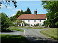
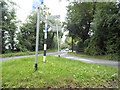
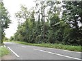
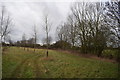
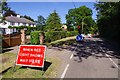


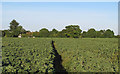
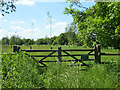
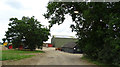
12 photos from this area
Area Information
Key information about the CM5 0DZ including its size, population, and administrative classification.
- Area Type
- Postcode
- Area Size
- 1.2 km²
- Population
- 2390
- Population Density
- 55 people/km²
House Prices in CM5 0DZ
19
Properties
£940,000
Average Sold Price
£375,000
Lowest Price
£2,650,000
Highest Price
Showing 19 properties
| Address | Type | Beds | Baths | Last Sale Price | Last Sale Date | |
|---|---|---|---|---|---|---|
| Mashams, Workers Road, High Laver, Ongar, CM5 0DZ | Detached | 5 | - | £650,000 | Sep 2021 | |
| Spinney Croft, Workers Road, High Laver, Ongar, CM5 0DZ | house | - | - | £755,000 | Mar 2021 | |
| Herbert House, Workers Road, High Laver, Ongar, CM5 0DZ | Detached | 5 | 3 | £2,650,000 | Sep 2020 | |
| South Wilmore Barn, Workers Road, High Laver, Ongar, CM5 0DZ | Detached | 4 | - | £735,000 | Jan 2016 | |
| 1, Spinney Cottages, Workers Road, High Laver, Ongar, CM5 0DZ | Semi-detached | - | - | £375,000 | Mar 2014 | |
| The Oates, Workers Road, High Laver, Ongar, CM5 0DZ | Bungalow | 5 | - | £815,000 | Feb 2014 | |
| North Wilmore Barn, Workers Road, High Laver, Ongar, CM5 0DZ | Semi-detached | 4 | - | £600,000 | Nov 2008 | |
| Spinney Farm Barn, Spinney Farm, Workers Road, High Laver, Ongar, CM5 0DZ | Detached | 5 | 3 | - | - | |
| Travellers Barn, Workers Road, High Laver, Ongar, CM5 0DZ | Detached | - | - | - | - | |
| Tennis 46M From The Oates 29M From Unnamed Road, Workers Road, High Laver, Ongar, CM5 0DZ | Leisure | - | - | - | - |
Page 1 of 2
Energy Efficiency in CM5 0DZ
Amenities
Schools
| Rank | School | Type | Entry gender | Ages |
|---|
Explore more schools in this area
Go to Schools tabDemographics
Household Size
Two person
most common
Accommodation Type
Houses
most common
Tenure
76
majority
Ethnic Group
White
most common
Religion
N/A
most common
Household Composition
N/A
most common
Age
47
median
Adults (30-64 years)
most common
Household Deprivation
N/A
with no deprivation
NS-SEC
39
in Lower managerial occupations
Explore more demographic insights in this area
Go to Demographics tabPlanning
Planning Constraints
- Flood RiskPremium
- Ramsar Wetland SitesPremium
- Area of Outstanding Natural BeautyPremium
- Protected Nature ReservePremium
- Protected WoodlandPremium