Area Overview for CM17 0NS
Photos of CM17 0NS
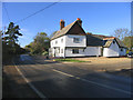
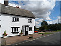
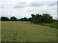
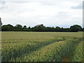
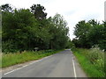
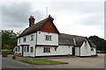

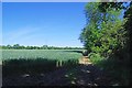
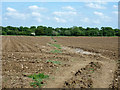
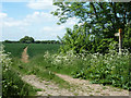
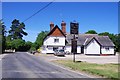
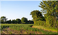
14 photos from this area
Area Information
Key information about the CM17 0NS including its size, population, and administrative classification.
- Area Type
- Postcode
- Area Size
- 1.9 km²
- Population
- 2390
- Population Density
- 55 people/km²
House Prices in CM17 0NS
38
Properties
£987,000
Average Sold Price
£560,000
Lowest Price
£1,500,000
Highest Price
Showing 38 properties
| Address | Type | Beds | Baths | Last Sale Price | Last Sale Date | |
|---|---|---|---|---|---|---|
| Holts Farm, Threshers Bush, Matching, Harlow, CM17 0NS | Office | 1 | 1 | £1,335,000 | May 2021 | |
| Green Oaks, Threshers Bush, Matching, Harlow, CM17 0NS | house | - | - | £850,000 | Apr 2018 | |
| Herds Farm, Threshers Bush, Matching, Harlow, CM17 0NS | Detached | - | - | £560,000 | Apr 2004 | |
| Mulberry Hall, Threshers Bush, Matching, Harlow, CM17 0NS | Detached | - | - | £1,500,000 | Mar 2004 | |
| Little Bundish, Threshers Bush, Matching, Harlow, CM17 0NS | Detached | - | - | £690,000 | Nov 2003 | |
| Pump House, Bush Hall Farm, Threshers Bush, Matching, Harlow, CM17 0NS | Detached | 3 | 2 | - | - | |
| The Maltings, Bush Hall Farm, Threshers Bush, Matching, Harlow, CM17 0NS | Detached | 7 | 2 | - | - | |
| Granary, Bush Hall Farm, Threshers Bush, Matching, Harlow, CM17 0NS | Semi-detached | 1 | - | - | - | |
| Carpenters House, Bush Hall Farm, Threshers Bush, Matching, Harlow, CM17 0NS | Semi-detached | 3 | 2 | - | - | |
| Bush Hall Farm, Threshers Bush, Matching, Harlow, CM17 0NS | Semi-detached | 3 | 2 | - | - |
Page 1 of 4
Energy Efficiency in CM17 0NS
Amenities
Schools
| Rank | School | Type | Entry gender | Ages |
|---|
Explore more schools in this area
Go to Schools tabDemographics
Household Size
Two person
most common
Accommodation Type
Houses
most common
Tenure
76
majority
Ethnic Group
White
most common
Religion
N/A
most common
Household Composition
N/A
most common
Age
47
median
Adults (30-64 years)
most common
Household Deprivation
N/A
with no deprivation
NS-SEC
39
in Lower managerial occupations
Explore more demographic insights in this area
Go to Demographics tabPlanning
Planning Constraints
- Flood RiskPremium
- Ramsar Wetland SitesPremium
- Area of Outstanding Natural BeautyPremium
- Protected Nature ReservePremium
- Protected WoodlandPremium