Area Overview for CM5 0DU
Photos of CM5 0DU


Area Information
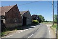
Living in CM5 0DU offers a grounded residential experience within a defined cluster covering 35.8 hectares. This specific postcode area accommodates a population of 2,390 people, resulting in a gentle population density of 55 people per square kilometre. The environment suits those seeking a contained community rather than a sprawling urban district. Daily life here centres on a local rhythm where residents navigate the immediate surroundings before travelling further afield for major services. The area functions primarily as a sleeping location for commuters, leveraging its position on key transport routes. You will find the streets are populated by established households rather than transient populations. The layout provides a clear sense of what to expect in terms of space and noise levels. It is an enclave defined by its residential purpose, making it easy to understand your limits and your reach from the threshold of your front door.
- Area Type
- Postcode
- Area Size
- 35.8 hectares
- Population
- 2390
- Population Density
- 55 people/km²
The property market in CM5 0DU is overwhelmingly dominated by owner-occupiers, with a home ownership rate of 76%. The entire accommodation type portfolio comprises houses, meaning you will not find purpose-built rental blocks or terraced housing within this specific cluster. This concentration suggests a market geared towards families and individuals seeking permanence rather than transient living arrangements. If you are considering buying homes in CM5 0DU, you are entering a sector where resale liquidity and long-term stability are key features. The lack of rental stock implies that supply is restricted and driven by local demand from people living locally. This dynamic can make acquiring a property more competitive if the current owner decides to sell. The focus on single-family dwellings also means that ground-floor units often present as the most affordable entry point. You should expect a traditional British housing stock distinct from the high-rise blocks found in central London. The market here operates on the principles of community and established value rather than speculative development.
House Prices in CM5 0DU
Showing 10 properties
Energy Efficiency in CM5 0DU
Residents of CM5 0DU have a convenient array of retail and transport amenities within practical reach. Local shopping options include M&S Harlow Gate BP, Morrisons Daily, and Tesco Harlow, providing essential groceries and daily necessities. These venues are part of a larger retail network that serves the wider Masham and Harlow Gate corridor. The area is positioned close to North Weald Airport, though this amenity functions primarily for aviation traffic rather than public leisure. For rail travel, Harlow Mill, Sawbridgeworth, and Harlow Town Railway Station offer frequent services to Romford and London. Epping Underground Station acts as a connected node for the London Underground network. This density of transport links ensures that you are never more than a short train ride from either the Greater London or Hertfordshire urban centres. Daily errands at Tesco Harlow or the convenience store at M&S Harlow Gate BP are easily integrated into a morning routine. The balance between local shops and major transport hubs creates a lifestyle that balances independence with connectivity.
Amenities
Schools
Families in CM5 0DU have access to several primary institutions within practical commuting distance of the postcode. Matching Green Church of England Voluntary Controlled Primary School and Moreton Church of England Voluntary Aided Primary School both hold a 'good' Ofsted rating. Dr Walker's Church of England Voluntary Controlled Primary School in Fyfield carries a 'satisfactory' rating from the regulator. Elmbridge School is also listed as a nearby option, though a specific Ofsted rating is not provided in current records. This mix allows parents to choose between institutions with distinct reputations based on their assessment outcomes. The presence of three rated schools suggests a reasonable catchment area for primary education without needing to travel across Harlow. When evaluating schools near CM5 0DU, you must check the specific boundaries of each institution as these are not guaranteed walk-ins. The majority of the options are Church of England faith schools, which may influence the teaching philosophy or community activities. You should verify entry methods and term dates for each school directly with the administration.
| Rank | School | Type | Entry gender | Ages |
|---|
Explore more schools in this area
Go to Schools tabDemographics
The community character of CM5 0DU reflects a stable household demographic with significant tenure security. Exactly 76% of residents are home owners, indicating a long-term commitment to the location. The building stock consists exclusively of houses, offering the privacy and space that these home ownership figures suggest is a priority. The median age of the population stands at 47 years, with adults aged between 30 and 64 forming the most common age range. This age profile points to a neighbourhood occupied by families and established professionals rather than young professionals or retirees. The predominant ethnic group is White, aligning with the broader demographic trends of many Hertfordshire locations. You can anticipate a familiar atmosphere where neighbours have known one another for years. The age distribution suggests a period of peak career and raising children rather than early adulthood or retirement. This consistency in age and tenure creates a predictable living environment that appeals to安家 (settled) families.
Household Size
Accommodation Type
Tenure
Ethnic Group
Religion
Household Composition
Age
Household Deprivation
NS-SEC
Explore more demographic insights in this area
Go to Demographics tabPlanning
Planning Constraints
- Flood RiskPremium
- Ramsar Wetland SitesPremium
- Area of Outstanding Natural BeautyPremium
- Protected Nature ReservePremium
- Protected WoodlandPremium