Area Overview for CM4 0JY
Photos of CM4 0JY
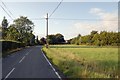
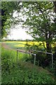
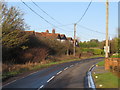
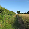
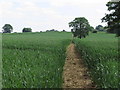
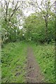
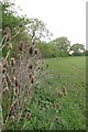
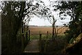
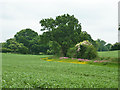
9 photos from this area
Area Information
Key information about the CM4 0JY including its size, population, and administrative classification.
- Area Type
- Postcode
- Area Size
- 62.9 hectares
- Population
- 2464
- Population Density
- 54 people/km²
House Prices in CM4 0JY
32
Properties
£620,999
Average Sold Price
£249,995
Lowest Price
£1,170,000
Highest Price
Showing 32 properties
| Address | Type | Beds | Baths | Last Sale Price | Last Sale Date | |
|---|---|---|---|---|---|---|
| Oakleigh, 202 Nine Ashes Road, High Ongar, Ongar, CM4 0JY | Detached | 4 | 2 | £1,170,000 | May 2019 | |
| 206 Nine Ashes Road, High Ongar, Ongar, CM4 0JY | Bungalow | 3 | 2 | £800,000 | Mar 2014 | |
| Dreamwood, 164 Nine Ashes Road, High Ongar, Ongar, CM4 0JY | house | - | - | £425,000 | Feb 2007 | |
| 208 Nine Ashes Road, High Ongar, Ongar, CM4 0JY | Detached | 4 | 3 | £249,995 | Oct 2002 | |
| Paslow Common Farmhouse, 184 Nine Ashes Road, High Ongar, Ongar, CM4 0JY | Detached | 4 | 3 | £460,000 | Jun 1998 | |
| Mayford, 174 Nine Ashes Road, High Ongar, Ongar, CM4 0JY | Detached | 4 | 2 | - | - | |
| Eleanor, 172 Nine Ashes Road, High Ongar, Ongar, CM4 0JY | Detached | 4 | 3 | - | - | |
| Mayflower Cottage, 168 Nine Ashes Road, High Ongar, Ongar, CM4 0JY | Semi-detached | 4 | 2 | - | - | |
| Sparks Farm, 187 Nine Ashes Road, High Ongar, Ongar, CM4 0JY | Semi-detached | 3 | 2 | - | - | |
| Stanlea, 170 Nine Ashes Road, High Ongar, Ongar, CM4 0JY | Detached | 4 | 2 | - | - |
Page 1 of 4
Energy Efficiency in CM4 0JY
Amenities
Schools
| Rank | School | Type | Entry gender | Ages |
|---|
Explore more schools in this area
Go to Schools tabDemographics
Household Size
Family (3-5 people)
most common
Accommodation Type
Houses
most common
Tenure
74
majority
Ethnic Group
White
most common
Religion
N/A
most common
Household Composition
N/A
most common
Age
47
median
Adults (30-64 years)
most common
Household Deprivation
N/A
with no deprivation
NS-SEC
37
in Lower managerial occupations
Explore more demographic insights in this area
Go to Demographics tabPlanning
Planning Constraints
- Flood RiskPremium
- Ramsar Wetland SitesPremium
- Area of Outstanding Natural BeautyPremium
- Protected Nature ReservePremium
- Protected WoodlandPremium