Area Overview for CM24 8UE
Photos of CM24 8UE
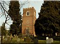
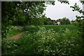
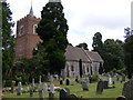
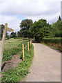
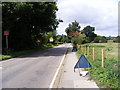
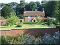
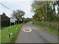
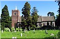


30 photos from this area
Area Information
Key information about the CM24 8UE including its size, population, and administrative classification.
- Area Type
- Postcode
- Area Size
- 45.3 hectares
- Population
- 1767
- Population Density
- 213 people/km²
House Prices in CM24 8UE
22
Properties
£360,273
Average Sold Price
£82,000
Lowest Price
£600,000
Highest Price
Showing 22 properties
| Address | Type | Beds | Baths | Last Sale Price | Last Sale Date | |
|---|---|---|---|---|---|---|
| 2, The Thatch, Burton End, Stansted, CM24 8UE | Semi-detached | - | - | £390,000 | Jun 2019 | |
| 1, The Thatch, Burton End, Stansted, CM24 8UE | Semi-detached | 1 | 1 | £265,000 | Mar 2019 | |
| The Haven, Burton End, Stansted, CM24 8UE | Terraced | 3 | 3 | £469,000 | Dec 2018 | |
| Rennisons, Burton End, Stansted, CM24 8UE | Cottage | 2 | 1 | £335,000 | Oct 2017 | |
| Cootys, Burton End, Stansted, CM24 8UE | Bungalow | - | - | £385,000 | Oct 2016 | |
| Moorlands, Burton End, Stansted, CM24 8UE | house | 6 | 3 | £500,000 | Feb 2014 | |
| The Cottage, Burton End, Stansted, CM24 8UE | house | 3 | - | £331,000 | Feb 2013 | |
| Avenue House, Burton End, Stansted, CM24 8UE | house | 5 | - | £600,000 | Sep 2010 | |
| Pelham Cottage, Burton End, Stansted, CM24 8UE | Semi-detached | - | - | £248,000 | Jun 2008 | |
| Burton Cottage, Burton End, Stansted, CM24 8UE | Semi-detached | - | - | £358,000 | Aug 2007 |
Page 1 of 3
Energy Efficiency in CM24 8UE
Amenities
Schools
| Rank | School | Type | Entry gender | Ages |
|---|
Explore more schools in this area
Go to Schools tabDemographics
Household Size
Family (3-5 people)
most common
Accommodation Type
Houses
most common
Tenure
55
majority
Ethnic Group
White
most common
Religion
N/A
most common
Household Composition
N/A
most common
Age
47
median
Adults (30-64 years)
most common
Household Deprivation
N/A
with no deprivation
NS-SEC
37
in Lower managerial occupations
Explore more demographic insights in this area
Go to Demographics tabPlanning
Planning Constraints
- Flood RiskPremium
- Ramsar Wetland SitesPremium
- Area of Outstanding Natural BeautyPremium
- Protected Nature ReservePremium
- Protected WoodlandPremium