Area Overview for CM2 8UE
Photos of CM2 8UE
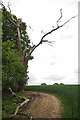
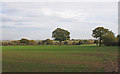
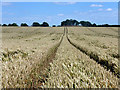
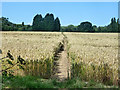
10 photos from this area
Area Information
Key information about the CM2 8UE including its size, population, and administrative classification.
- Area Type
- Postcode
- Area Size
- 12.1 hectares
- Population
- 1495
- Population Density
- 133 people/km²
House Prices in CM2 8UE
6
Properties
£664,500
Average Sold Price
£320,000
Lowest Price
£1,200,000
Highest Price
Showing 6 properties
| Address | Type | Beds | Baths | Last Sale Price | Last Sale Date | |
|---|---|---|---|---|---|---|
| Wheelgates, West Hanningfield Road, West Hanningfield, Chelmsford, CM2 8UE | Detached | 2 | 2 | £660,000 | May 2025 | |
| Green Acres, West Hanningfield Road, West Hanningfield, Chelmsford, CM2 8UE | Detached | - | - | £1,200,000 | Jun 2021 | |
| Garden Cottage, West Hanningfield Road, West Hanningfield, Chelmsford, CM2 8UE | Detached | - | - | £478,000 | Jan 2007 | |
| Tanda Kia, West Hanningfield Road, West Hanningfield, Chelmsford, CM2 8UE | Semi-detached | - | - | £320,000 | Oct 2001 | |
| Annexe At, Green Acres, West Hanningfield Road, West Hanningfield, Chelmsford, CM2 8UE | Semi-detached | - | - | - | - | |
| Elms Farm, Elms Farm Lane, West Hanningfield, Chelmsford, CM2 8UE | Detached | - | - | - | - |
Energy Efficiency in CM2 8UE
Amenities
Schools
| Rank | School | Type | Entry gender | Ages |
|---|
Explore more schools in this area
Go to Schools tabDemographics
Household Size
One person
most common
Accommodation Type
Houses
most common
Tenure
86
majority
Ethnic Group
White
most common
Religion
N/A
most common
Household Composition
N/A
most common
Age
47
median
Adults (30-64 years)
most common
Household Deprivation
N/A
with no deprivation
NS-SEC
42
in Lower managerial occupations
Explore more demographic insights in this area
Go to Demographics tabPlanning
Planning Constraints
- Flood RiskPremium
- Ramsar Wetland SitesPremium
- Area of Outstanding Natural BeautyPremium
- Protected Nature ReservePremium
- Protected WoodlandPremium