Area Overview for CM2 7RQ
Photos of CM2 7RQ
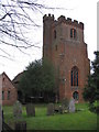
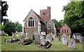
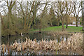

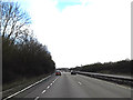
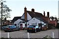
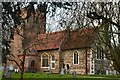
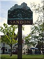
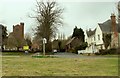
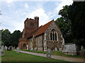
32 photos from this area
Area Information
Key information about the CM2 7RQ including its size, population, and administrative classification.
- Area Type
- Postcode
- Area Size
- 4.4 hectares
- Population
- 1535
- Population Density
- 146 people/km²
House Prices in CM2 7RQ
36
Properties
£232,346
Average Sold Price
£27,450
Lowest Price
£615,000
Highest Price
Showing 36 properties
| Address | Type | Beds | Baths | Last Sale Price | Last Sale Date | |
|---|---|---|---|---|---|---|
| 30 Hall Lane, Sandon, Chelmsford, CM2 7RQ | Semi-detached | 5 | 3 | £615,000 | Sep 2024 | |
| 76 Hall Lane, Sandon, Chelmsford, CM2 7RQ | Semi-detached | 6 | 2 | £395,000 | Feb 2019 | |
| 72 Hall Lane, Sandon, Chelmsford, CM2 7RQ | Semi-detached | 4 | 1 | £315,000 | Dec 2015 | |
| 90 Hall Lane, Sandon, Chelmsford, CM2 7RQ | house | - | - | £405,000 | Dec 2013 | |
| 40 Hall Lane, Sandon, Chelmsford, CM2 7RQ | Terraced | 3 | - | £235,000 | Dec 2013 | |
| 80 Hall Lane, Sandon, Chelmsford, CM2 7RQ | Semi-detached | 4 | - | £242,500 | Mar 2013 | |
| 10 Hall Lane, Sandon, Chelmsford, CM2 7RQ | Semi-detached | - | - | £275,000 | Aug 2007 | |
| 82 Hall Lane, Sandon, Chelmsford, CM2 7RQ | house | - | - | £154,950 | Aug 2002 | |
| 22 Hall Lane, Sandon, Chelmsford, CM2 7RQ | Terraced | - | - | £85,000 | Jan 2001 | |
| 70 Hall Lane, Sandon, Chelmsford, CM2 7RQ | house | - | - | £135,000 | Sep 2000 |
Page 1 of 4
Energy Efficiency in CM2 7RQ
Amenities
Schools
| Rank | School | Type | Entry gender | Ages |
|---|
Explore more schools in this area
Go to Schools tabDemographics
Household Size
Family (3-5 people)
most common
Accommodation Type
Houses
most common
Tenure
84
majority
Ethnic Group
White
most common
Religion
N/A
most common
Household Composition
N/A
most common
Age
47
median
Adults (30-64 years)
most common
Household Deprivation
N/A
with no deprivation
NS-SEC
45
in Lower managerial occupations
Explore more demographic insights in this area
Go to Demographics tabPlanning
Planning Constraints
- Flood RiskPremium
- Ramsar Wetland SitesPremium
- Area of Outstanding Natural BeautyPremium
- Protected Nature ReservePremium
- Protected WoodlandPremium