Area Overview for CM2 7RJ
Photos of CM2 7RJ
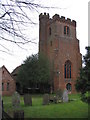
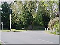
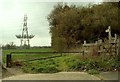
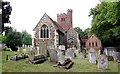
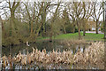

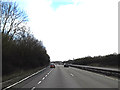
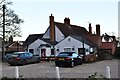
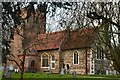
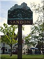
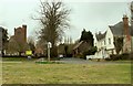

32 photos from this area
Area Information
Key information about the CM2 7RJ including its size, population, and administrative classification.
- Area Type
- Postcode
- Area Size
- 2.2 hectares
- Population
- 1535
- Population Density
- 146 people/km²
House Prices in CM2 7RJ
36
Properties
£356,823
Average Sold Price
£56,000
Lowest Price
£615,000
Highest Price
Showing 36 properties
| Address | Type | Beds | Baths | Last Sale Price | Last Sale Date | |
|---|---|---|---|---|---|---|
| 43 Hall Lane, Sandon, Chelmsford, CM2 7RJ | Semi-detached | 3 | 1 | £385,000 | Sep 2024 | |
| 19 Hall Lane, Sandon, Chelmsford, CM2 7RJ | Terraced | 2 | 1 | £300,000 | Jun 2024 | |
| 45 Hall Lane, Sandon, Chelmsford, CM2 7RJ | Semi-detached | 5 | 1 | £615,000 | Apr 2024 | |
| 11 Hall Lane, Sandon, Chelmsford, CM2 7RJ | house | - | - | £615,000 | Nov 2022 | |
| 41 Hall Lane, Sandon, Chelmsford, CM2 7RJ | Semi-detached | 4 | 2 | £430,000 | Oct 2022 | |
| 17 Hall Lane, Sandon, Chelmsford, CM2 7RJ | Flat | - | - | £215,000 | May 2021 | |
| 15 Hall Lane, Sandon, Chelmsford, CM2 7RJ | Semi-detached | 4 | - | £475,000 | Sep 2020 | |
| 63 Hall Lane, Sandon, Chelmsford, CM2 7RJ | Semi-detached | 4 | 2 | £460,000 | Jan 2018 | |
| 67 Hall Lane, Sandon, Chelmsford, CM2 7RJ | Semi-detached | 5 | 1 | £440,000 | Jul 2017 | |
| 65 Hall Lane, Sandon, Chelmsford, CM2 7RJ | house | - | - | £350,000 | Oct 2016 |
Page 1 of 4
Energy Efficiency in CM2 7RJ
Amenities
Schools
| Rank | School | Type | Entry gender | Ages |
|---|
Explore more schools in this area
Go to Schools tabDemographics
Household Size
Family (3-5 people)
most common
Accommodation Type
Houses
most common
Tenure
84
majority
Ethnic Group
White
most common
Religion
N/A
most common
Household Composition
N/A
most common
Age
47
median
Adults (30-64 years)
most common
Household Deprivation
N/A
with no deprivation
NS-SEC
45
in Lower managerial occupations
Explore more demographic insights in this area
Go to Demographics tabPlanning
Planning Constraints
- Flood RiskPremium
- Ramsar Wetland SitesPremium
- Area of Outstanding Natural BeautyPremium
- Protected Nature ReservePremium
- Protected WoodlandPremium