Area Overview for CM18 7DU
Photos of CM18 7DU


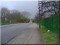
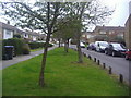
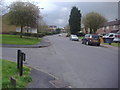
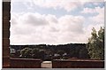
12 photos from this area
Area Information
Key information about the CM18 7DU including its size, population, and administrative classification.
- Area Type
- Postcode
- Area Size
- 6616 m²
- Population
- Not available
- Population Density
- Not available
House Prices in CM18 7DU
20
Properties
£283,964
Average Sold Price
£161,000
Lowest Price
£365,000
Highest Price
Showing 20 properties
| Address | Type | Beds | Baths | Last Sale Price | Last Sale Date | |
|---|---|---|---|---|---|---|
| 130 Wharley Hook, Harlow, CM18 7DU | Terraced | 3 | 1 | £362,500 | Jan 2024 | |
| 145 Wharley Hook, Harlow, CM18 7DU | house | - | - | £365,000 | Dec 2021 | |
| 135 Wharley Hook, Harlow, CM18 7DU | house | - | - | £335,000 | Sep 2021 | |
| 140 Wharley Hook, Harlow, CM18 7DU | Terraced | 3 | 1 | £310,000 | Nov 2020 | |
| 144 Wharley Hook, Harlow, CM18 7DU | Terraced | 3 | 1 | £290,000 | Jul 2017 | |
| 138 Wharley Hook, Harlow, CM18 7DU | house | - | - | £161,000 | Dec 2009 | |
| 143 Wharley Hook, Harlow, CM18 7DU | Terraced | 3 | 1 | £164,250 | Apr 2005 | |
| 131 Wharley Hook, Harlow, CM18 7DU | house | 3 | 1 | - | - | |
| 132 Wharley Hook, Harlow, CM18 7DU | Terraced | - | - | - | - | |
| 134 Wharley Hook, Harlow, CM18 7DU | Terraced | - | - | - | - |
Page 1 of 2
Energy Efficiency in CM18 7DU
Amenities
Schools
| Rank | School | Type | Entry gender | Ages |
|---|
Explore more schools in this area
Go to Schools tabDemographics
Household Size
Family (3-5 people)
most common
Accommodation Type
Houses
most common
Tenure
67
majority
Ethnic Group
White
most common
Religion
N/A
most common
Household Composition
N/A
most common
Age
47
median
Adults (30-64 years)
most common
Household Deprivation
N/A
with no deprivation
NS-SEC
29
in Lower managerial occupations
Explore more demographic insights in this area
Go to Demographics tabPlanning
Planning Constraints
- Flood RiskPremium
- Ramsar Wetland SitesPremium
- Area of Outstanding Natural BeautyPremium
- Protected Nature ReservePremium
- Protected WoodlandPremium