Area Overview for CM17 0NX
Photos of CM17 0NX
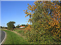
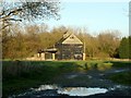
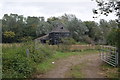
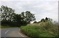
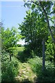

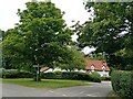
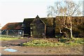
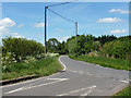
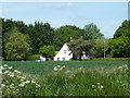
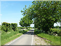

12 photos from this area
Area Information
Key information about the CM17 0NX including its size, population, and administrative classification.
- Area Type
- Postcode
- Area Size
- 52.0 hectares
- Population
- 2350
- Population Density
- 87 people/km²
House Prices in CM17 0NX
18
Properties
£1,045,000
Average Sold Price
£325,000
Lowest Price
£1,925,000
Highest Price
Showing 18 properties
| Address | Type | Beds | Baths | Last Sale Price | Last Sale Date | |
|---|---|---|---|---|---|---|
| 5, Grainstore, Carters Green, Matching, Harlow, CM17 0NX | house | - | - | £625,000 | May 2025 | |
| Broadlands, Carters Green, Matching, Harlow, CM17 0NX | Detached | 5 | 3 | £1,925,000 | May 2024 | |
| Tadgells Barn, Carters Green, Matching, Harlow, CM17 0NX | house | - | - | £1,200,000 | Oct 2021 | |
| Hoggs Farm, Carters Green, Matching, Harlow, CM17 0NX | Detached | 4 | 2 | £1,150,000 | Jul 2018 | |
| Badgers, Carters Green, Matching, Harlow, CM17 0NX | Detached | 5 | 3 | £325,000 | Mar 2016 | |
| 2, Grainstore, Carters Green, Matching, Harlow, CM17 0NX | Terraced | 4 | 3 | - | - | |
| 1, Grainstore, Carters Green, Matching, Harlow, CM17 0NX | Terraced | 5 | 3 | - | - | |
| Ark Royal, Carters Green, Matching, Harlow, CM17 0NX | Detached | 3 | 2 | - | - | |
| 3, Grainstore, Carters Green, Matching, Harlow, CM17 0NX | Bungalow | 3 | 2 | - | - | |
| 4, Grainstore, Carters Green, Matching, Harlow, CM17 0NX | Terraced | 3 | 2 | - | - |
Page 1 of 2
Energy Efficiency in CM17 0NX
Amenities
Schools
| Rank | School | Type | Entry gender | Ages |
|---|
Explore more schools in this area
Go to Schools tabDemographics
Household Size
Family (3-5 people)
most common
Accommodation Type
Houses
most common
Tenure
77
majority
Ethnic Group
White
most common
Religion
N/A
most common
Household Composition
N/A
most common
Age
47
median
Adults (30-64 years)
most common
Household Deprivation
N/A
with no deprivation
NS-SEC
39
in Lower managerial occupations
Explore more demographic insights in this area
Go to Demographics tabPlanning
Planning Constraints
- Flood RiskPremium
- Ramsar Wetland SitesPremium
- Area of Outstanding Natural BeautyPremium
- Protected Nature ReservePremium
- Protected WoodlandPremium