Area Overview for CM14 5QW
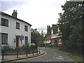
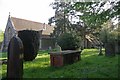
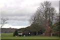
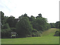
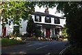
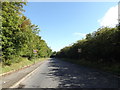
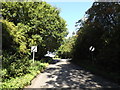
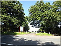
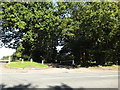
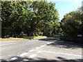
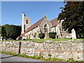
Photos of CM14 5QW

Area Information
Residing in the CM14 5QW postcode represents a move to a small, tightly knit residential cluster situated within the Borough of Brentwood in Essex. This specific area covers just 1.1 hectares, a compact footprint that supports a population of 2,012 people. The low area size creates a close-knit environment where the built environment remains defined by density constraints rather than sprawling development. You are living in a location where the sprawling nature of low-density housing contrasts with the concentrated reality of the local postcode. Daily life revolves around the immediate community, characterised by a distinct lack of large-scale commercialisation within the square metres of the residential zone. The setting is grounded in the wider history of Brizes, Stondon Massey, and South Weald, offering a grounded connection to the past without the chaos of urban centres. The immediate vicinity aligns with the village and civil parish of Stondon Massey, sitting north of Brentwood between Blackmore and Doddinghurst. This provides a backdrop of stability for those seeking homes in CM14 5QW. For families and individuals, the area offers a balance of historical context and practical living space. The popularity of the area stems from its established nature within the Eastern region. You are getting a slice of residential England that prioritises space over skyscrapers. The specific coordinates and land alignment ensure that every property exists within a regulated, understood landscape. This is a place where you live among neighbours who have lived there for generations, fostering a sense of permanence.
- Area Type
- Postcode
- Area Size
- 1.1 hectares
- Population
- 2012
- Population Density
- 169 people/km²
The property market in CM14 5QW is characterised by a strong leaning towards owner-occupancy, with 81% of dwellings held in private hands. This figure far exceeds the national average for rental-heavy cities, indicating a mature market where residents have secured their homes through purchase. The accommodation type reflects this stability; houses dominate the housing stock, offering the space and私密性 that families and retirees typically prioritise. When looking for homes in CM14 5QW, you are entering a market where competition is usually for established properties rather than new builds or speculative short-lets. Because the area covers a small cluster of just 1.1 hectares, the number of available listings is inherently limited at any given time. This scarcity often means that properties move quickly once they hit the market. Buyers looking at this postcode should expect to compete with other serious purchasers who value the security of ownership over the flexibility of renting. The high home ownership rate also suggests that social ties within the neighbourhood are deep-rooted, as sellers are often exiting seats they have held for decades. For you, this means buying a home here involves stepping into an existing community rather than displacing transient tenants. The housing mix remains consistent, with no sudden shifts towards student accommodation or corporate housing.
House Prices in CM14 5QW
Showing 12 properties
| Address | Type | Beds | Baths | Last Sale Price | Last Sale Date | |
|---|---|---|---|---|---|---|
| 9, Almshouses, Wigley Bush Lane, South Weald, CM14 5QW | Terraced | - | - | - | - | |
| 8, Almshouses, Wigley Bush Lane, South Weald, CM14 5QW | Terraced | - | - | - | - | |
| 2, Almshouses, Wigley Bush Lane, South Weald, CM14 5QW | Bungalow | - | - | - | - | |
| 11, Almshouses, Wigley Bush Lane, South Weald, CM14 5QW | Semi-detached | - | - | - | - | |
| 7, Almshouses, Wigley Bush Lane, South Weald, CM14 5QW | Terraced | - | - | - | - | |
| 6, Almshouses, Wigley Bush Lane, South Weald, CM14 5QW | Terraced | - | - | - | - | |
| 5, Almshouses, Wigley Bush Lane, South Weald, CM14 5QW | Bungalow | - | - | - | - | |
| 3, Almshouses, Wigley Bush Lane, South Weald, CM14 5QW | Bungalow | - | - | - | - | |
| 10, Almshouses, Wigley Bush Lane, South Weald, CM14 5QW | Terraced | - | - | - | - | |
| 1, Almshouses, Wigley Bush Lane, South Weald, CM14 5QW | Bungalow | - | - | - | - |
Energy Efficiency in CM14 5QW
Your daily life in CM14 5QW is supported by a ring of amenities within reasonable travelling distance. For shopping, you are near five retail outlets including Tesco Brentwood, M&S on Ongar Road in Brentwood, and Morrisons Daily. These stores provide everything from fresh groceries to household essentials, ensuring you never need to travel far for daily provisions. For those without vehicles, or during rainy weather, these shops offer convenient alternatives to full supermarkets. Transport options are extensive, with five railway stations including Brentwood and Shenfield serving the area, alongside three metro stations such as Upminster Bridge and Elm Park. This network allows you to combine a quiet residential life with easy access to city centres. Local character is defined by established landmarks like the Church of St Peter's and St Paul's and historic estates such as Stondon Place and Brizes Park. The village green in Stondon Massey hosts an annual fete, providing a focal point for local community engagement. You are living near rich history without sacrificing access to modern convenience. The mix of retail and leisure facilities ensures that you can enjoy a balanced lifestyle, where work, play, and relaxation are all geographically close.
Amenities
Schools
For families considering living in CM14 5QW, the educational landscape offers immediate high-quality access. The nearest primary education provision is St Peter's Church of England Voluntary Aided Primary School in South Weald. This institution holds an Ofsted rating of outstanding, a designation reflecting exceptional standards in student achievement and curriculum delivery. The presence of an outstanding-rated school directly impacts the desirability of homes in the vicinity, as parents prioritise environments where educational outcomes are guaranteed. You do not need to look far beyond the immediate neighbourhood to find top-tier academic facilities. The primary sector is particularly strong here, meaning families with young children can settle into a robust educational system without relocating further afield for schooling. While there are no secondary schools listed in the immediate vicinity data, the proximity of St Peter's indicates a focus on early development and foundational learning. The school type, being Voluntary Aided, suggests a community-owned body with close ties to the local parish and residents. This alignment with the Church of England ethos may also resonate with religious families. For those in the 30-64 age range, the ability to register a child at such a highly rated school immediately upon moving is a significant practical advantage. It removes the uncertainty of waiting for school catchment changes or needing to commute to other towns for primary education.
| Rank | School | Type | Entry gender | Ages |
|---|
Explore more schools in this area
Go to Schools tabDemographics
The community surrounding CM14 5QW is defined by a mature resident base with a median age of 47 years. Most common is the adult demographic, specifically those aged between 30 and 64 years. This age profile indicates a neighbourhood where raising families and establishing long-term careers are central to life. You are likely to encounter neighbours who have remained in the area for extended periods, contributing to a stable social fabric. Home ownership stands at an impressive 81%, evidencing a strong preference for buying rather than renting. This high rate suggests that many residents have made a significant investment in their local homes and view the area as a long-term commitment. The predominant accommodation type consists of houses, reflecting the traditional layout of settlements like Stondon Massey and South Weald. There are no purpose-built high-rise blocks; instead, the housing stock aligns with single-family or semi-detached properties. The predominant ethnic group is White, consistent with the broader demographic patterns of the Borough of Brentwood. This homogeneity often translates to a neighbourhood where cultural traditions are shared and community events are universally understood. With 169 people per square kilometre, the population density ensures you do not feel isolated, yet the low density prevents the noise and congestion of city living.
Household Size
Accommodation Type
Tenure
Ethnic Group
Religion
Household Composition
Age
Household Deprivation
NS-SEC
Explore more demographic insights in this area
Go to Demographics tabPlanning
Planning Constraints
- Flood RiskPremium
- Ramsar Wetland SitesPremium
- Area of Outstanding Natural BeautyPremium
- Protected Nature ReservePremium
- Protected WoodlandPremium