Area Overview for CM14 5QS
Photos of CM14 5QS

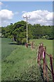
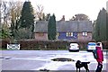
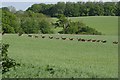
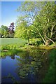
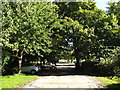
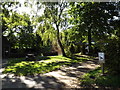
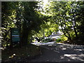

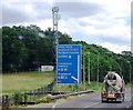
23 photos from this area
Area Information
Key information about the CM14 5QS including its size, population, and administrative classification.
- Area Type
- Postcode
- Area Size
- 1.4 km²
- Population
- 2012
- Population Density
- 169 people/km²
House Prices in CM14 5QS
15
Properties
£755,000
Average Sold Price
£600,000
Lowest Price
£910,000
Highest Price
Showing 15 properties
| Address | Type | Beds | Baths | Last Sale Price | Last Sale Date | |
|---|---|---|---|---|---|---|
| The Mimosa House, Weald Road, South Weald, CM14 5QS | Detached | 5 | 3 | £910,000 | Sep 2023 | |
| Rochetts Lodge, Weald Road, South Weald, CM14 5QS | Detached | - | - | £600,000 | Jul 2016 | |
| 3, Keepers Cottage, Weald Road, South Weald, CM14 5QS | Land | - | - | - | - | |
| 1, Rochetts, Weald Road, South Weald, CM14 5QS | Semi-detached | 3 | - | - | - | |
| Tennis 58M From 1 Rochetts, Weald Road 44M From Unnamed Road, Weald Road, South Weald, CM14 5QS | Leisure | - | - | - | - | |
| Park Rangers Office, Weald Country Park, Weald Road, Brentwood, CM14 5QS | Office | - | - | - | - | |
| Garden Cottage, Rochetts, Weald Road, South Weald, CM14 5QS | Detached | - | - | - | - | |
| Rochetts Estate Management Limited, Meadow Cottage, Rochetts, Weald Road, South Weald, CM14 5QS | Detached | - | - | - | - | |
| Plantation Cottage, Rochetts, Weald Road, South Weald, CM14 5QS | Bungalow | 3 | - | - | - | |
| Fleet Cottage, Rochetts, Weald Road, South Weald, CM14 5QS | Detached | - | - | - | - |
Page 1 of 2
Energy Efficiency in CM14 5QS
Amenities
Schools
| Rank | School | Type | Entry gender | Ages |
|---|
Explore more schools in this area
Go to Schools tabDemographics
Household Size
Family (3-5 people)
most common
Accommodation Type
Houses
most common
Tenure
81
majority
Ethnic Group
White
most common
Religion
N/A
most common
Household Composition
N/A
most common
Age
47
median
Adults (30-64 years)
most common
Household Deprivation
N/A
with no deprivation
NS-SEC
42
in Lower managerial occupations
Explore more demographic insights in this area
Go to Demographics tabPlanning
Planning Constraints
- Flood RiskPremium
- Ramsar Wetland SitesPremium
- Area of Outstanding Natural BeautyPremium
- Protected Nature ReservePremium
- Protected WoodlandPremium