Area Overview for CM14 4YG
Photos of CM14 4YG
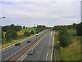
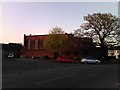
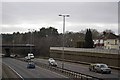
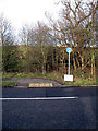
28 photos from this area
Area Information
Key information about the CM14 4YG including its size, population, and administrative classification.
- Area Type
- Postcode
- Area Size
- 1.1 hectares
- Population
- 1865
- Population Density
- 5223 people/km²
House Prices in CM14 4YG
33
Properties
£227,028
Average Sold Price
£12,500
Lowest Price
£470,000
Highest Price
Showing 33 properties
| Address | Type | Beds | Baths | Last Sale Price | Last Sale Date | |
|---|---|---|---|---|---|---|
| 28 Upper Ryle, Brentwood, CM14 4YG | Terraced | 4 | 1 | £450,000 | Nov 2023 | |
| 8 Upper Ryle, Brentwood, CM14 4YG | Terraced | 3 | 1 | £470,000 | Jul 2022 | |
| 23 Upper Ryle, Brentwood, CM14 4YG | Terraced | 3 | - | £442,000 | Nov 2021 | |
| 1 Upper Ryle, Brentwood, CM14 4YG | Terraced | 3 | 1 | £457,000 | Jan 2021 | |
| 32 Upper Ryle, Brentwood, CM14 4YG | Terraced | 4 | 1 | £300,000 | Oct 2018 | |
| 33 Upper Ryle, Brentwood, CM14 4YG | house | 3 | - | £205,000 | Dec 2012 | |
| 27 Upper Ryle, Brentwood, CM14 4YG | Terraced | 4 | - | £220,000 | May 2012 | |
| 18 Upper Ryle, Brentwood, CM14 4YG | Terraced | 4 | 1 | £229,000 | Sep 2011 | |
| 9 Upper Ryle, Brentwood, CM14 4YG | house | - | - | £198,000 | Nov 2005 | |
| 3 Upper Ryle, Brentwood, CM14 4YG | Terraced | - | - | £246,000 | May 2005 |
Page 1 of 4
Energy Efficiency in CM14 4YG
Amenities
Schools
| Rank | School | Type | Entry gender | Ages |
|---|
Explore more schools in this area
Go to Schools tabDemographics
Household Size
Family (3-5 people)
most common
Accommodation Type
Houses
most common
Tenure
56
majority
Ethnic Group
White
most common
Religion
N/A
most common
Household Composition
N/A
most common
Age
47
median
Adults (30-64 years)
most common
Household Deprivation
N/A
with no deprivation
NS-SEC
35
in Lower managerial occupations
Explore more demographic insights in this area
Go to Demographics tabPlanning
Planning Constraints
- Flood RiskPremium
- Ramsar Wetland SitesPremium
- Area of Outstanding Natural BeautyPremium
- Protected Nature ReservePremium
- Protected WoodlandPremium