Area Overview for CM14 4UF
Photos of CM14 4UF


Area Information
Living in CM14 4UF means residing in a compact residential cluster defined by postcode CM14 4UF. This specific area covers just 6734 square metres and supports a population of 1865 people. The location sits within Brentwood North, a district council ward governed by Brentwood Borough Council. You will find specific streets such as Honeypot Lane and Eald Close fall within the ward boundaries near these coordinates. The density here is exceptionally high, reaching 276957 people per square kilometre, which indicates a tightly knit neighbourhood structure. Despite the concentrated footprint, the area functions as a practical residential hub close to key transport links. Daily life in this postcode area is shaped by its proximity to major rail stations and retail centres. Residents of CM14 4UF benefit from immediate access to Brentwood Railway Station and Shenfield Railway Station. The surrounding environment offers a balance of private housing and community amenities. Buying a home in CM14 4UF provides entry to a settled environment where infrastructure supports modern living needs. The area represents a specific slice of the Brentwood market, offering a contained yet well-connected home environment. You can expect a stable setting where the local estate and services are tailored to the needs of this distinct demographic group. The physical size of the neighbourhood ensures that you remain close to your neighbours while maintaining access to the wider borough's facilities.
- Area Type
- Postcode
- Area Size
- 6734 m²
- Population
- 1865
- Population Density
- 5223 people/km²
The property market in CM14 4UF is defined by its strong owner-occupier base. Eighty-eight percent of the census response might suggest a mix, but the data confirms that 56% of the population is classified as homeowners. This substantial figure points to an established market where families and professionals have put down roots. The accommodation type is overwhelmingly houses, suggesting a property stock geared towards those seeking space and traditional living arrangements. When looking for homes in CM14 4UF, you are entering a predominantly owner-occupied sector. Buy-to-let investments may be less prevalent here compared to high-density student areas or major city centres. The small area size of 6734 square metres limits the inventory, making each property significant. Buyers considering CM14 4UF should aim for houses, as these represent the primary stock. The high home ownership rate suggests that sellers in this postcode area often value long-term equity growth over quick capital depreciation. You can expect a market characterised by stability rather than rapid turnover. The property types available will suit those who prioritise standalone living within a council ward that values residential continuity.
House Prices in CM14 4UF
Showing 59 properties
| Address | Type | Beds | Baths | Last Sale Price | Last Sale Date | |
|---|---|---|---|---|---|---|
| 19 Capon Close, Brentwood, CM14 4UF | undefined | - | - | - | - | |
| 49 Capon Close, Brentwood, CM14 4UF | undefined | - | - | - | - | |
| 53 Capon Close, Brentwood, CM14 4UF | Flat | - | - | - | - | |
| 27 Capon Close, Brentwood, CM14 4UF | undefined | - | - | - | - | |
| 57 Capon Close, Brentwood, CM14 4UF | Flat | - | - | - | - | |
| 7 Capon Close, Brentwood, CM14 4UF | Flat | - | - | - | - | |
| 47 Capon Close, Brentwood, CM14 4UF | undefined | - | - | - | - | |
| 33 Capon Close, Brentwood, CM14 4UF | undefined | - | - | - | - | |
| 3 Capon Close, Brentwood, CM14 4UF | Flat | - | - | - | - | |
| 59 Capon Close, Brentwood, CM14 4UF | Flat | - | - | - | - |
Energy Efficiency in CM14 4UF
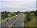
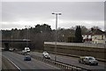
Your daily lifestyle in CM14 4UF benefits from immediate access to essential amenities and transport links. The area is surrounded by five major retail outlets, including Morrisons Daily, Sainsburys Brentwood, and Tesco High. These supermarkets are within practical reach, allowing you to complete grocery shopping and daily errands efficiently. For commuters, five railway stations serve the vicinity, with Brentwood Railway Station and Shenfield Railway Station being the nearest major hubs. You also have access to two metro stations, such as Upminster Bridge and Hornchurch, for wider London connectivity. Living in CM14 4UF places you at the intersection of retail convenience and transport networks. You can walk to key shops or easily hop on a train to explore Brentwood Borough Council areas further afield. The presence of these specific venues like Sainsburys Brentwood means you do not need to travel far for basic needs. Morning commutes to central London or business districts become manageable via the available rail services. The layout supports a lifestyle where work and leisure balance easily. Residents enjoy the freedom to choose between local shopping trips or longer journeys depending on their schedule. This mix of proximity and connectivity defines the character of life in this postcode.
Amenities
Schools
| Rank | School | Type | Entry gender | Ages |
|---|
Explore more schools in this area
Go to Schools tabDemographics
The community in CM14 4UF features a mature demographic profile. The median age stands at 47 years, reflecting an older population compared to the national average. Adults between 30 and 64 years old form the most common age range within this postcode cluster. Home ownership is the dominant housing tenure, with 56% of residents owning their property outright or with a mortgage. This figure indicates a stable community where long-term residence is common. Accommodation in CM14 4UF consists primarily of houses rather than flats or apartments. This focus on detached or semi-detached homes aligns with the preferences of the adult majority. The predominant ethnic group in the area is White, mirroring the broader trends of the region. With such a high percentage of owner-occupiers, the area likely hosts many multi-generational families and retirees seeking stability. The absence of significant rental data in this specific small cluster suggests a tight-knit, established local society. You will find that neighbours here likely have lived in the same houses for extended periods. This demographic composition creates a quiet, predictable atmosphere where community values are likely prioritised over transient lifestyles.
Household Size
Accommodation Type
Tenure
Ethnic Group
Religion
Household Composition
Age
Household Deprivation
NS-SEC
Explore more demographic insights in this area
Go to Demographics tabPlanning
Planning Constraints
- Flood RiskPremium
- Ramsar Wetland SitesPremium
- Area of Outstanding Natural BeautyPremium
- Protected Nature ReservePremium
- Protected WoodlandPremium