Area Overview for CM14 4TT
Photos of CM14 4TT
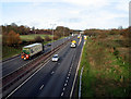
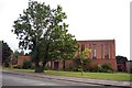
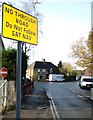
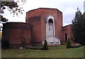
28 photos from this area
Area Information
Key information about the CM14 4TT including its size, population, and administrative classification.
- Area Type
- Postcode
- Area Size
- 6254 m²
- Population
- 1649
- Population Density
- 6739 people/km²
House Prices in CM14 4TT
7
Properties
£531,600
Average Sold Price
£170,000
Lowest Price
£955,000
Highest Price
Showing 7 properties
| Address | Type | Beds | Baths | Last Sale Price | Last Sale Date | |
|---|---|---|---|---|---|---|
| 95 Park Road, Brentwood, CM14 4TT | Detached | 5 | 3 | £955,000 | Jul 2020 | |
| 103 Park Road, Brentwood, CM14 4TT | house | 5 | - | £804,000 | Jun 2018 | |
| 86 Park Road, Brentwood, CM14 4TT | Detached | - | - | £485,000 | Dec 2006 | |
| 99 Park Road, Brentwood, CM14 4TT | Detached | 4 | 2 | £244,000 | Mar 1998 | |
| Wealdene, 105 Park Road, Brentwood, CM14 4TT | Detached | - | - | £170,000 | Mar 1995 | |
| 101 Park Road, Brentwood, CM14 4TT | Detached | - | - | - | - | |
| 97 Park Road, Brentwood, CM14 4TT | Detached | - | - | - | - |
Energy Efficiency in CM14 4TT
Amenities
Schools
| Rank | School | Type | Entry gender | Ages |
|---|
Explore more schools in this area
Go to Schools tabDemographics
Household Size
Family (3-5 people)
most common
Accommodation Type
Houses
most common
Tenure
70
majority
Ethnic Group
White
most common
Religion
N/A
most common
Household Composition
N/A
most common
Age
47
median
Adults (30-64 years)
most common
Household Deprivation
N/A
with no deprivation
NS-SEC
45
in Lower managerial occupations
Explore more demographic insights in this area
Go to Demographics tabPlanning
Planning Constraints
- Flood RiskPremium
- Ramsar Wetland SitesPremium
- Area of Outstanding Natural BeautyPremium
- Protected Nature ReservePremium
- Protected WoodlandPremium