Area Overview for CM14 4TG
Photos of CM14 4TG
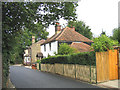
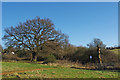

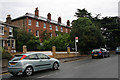

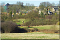
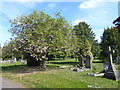
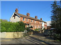

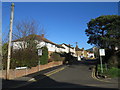
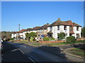
30 photos from this area
Area Information
Key information about the CM14 4TG including its size, population, and administrative classification.
- Area Type
- Postcode
- Area Size
- 1.5 hectares
- Population
- 1415
- Population Density
- 3843 people/km²
House Prices in CM14 4TG
44
Properties
£146,917
Average Sold Price
£29,500
Lowest Price
£214,000
Highest Price
Showing 44 properties
| Address | Type | Beds | Baths | Last Sale Price | Last Sale Date | |
|---|---|---|---|---|---|---|
| 94, Drake House, Sir Francis Way, Brentwood, CM14 4TG | Flat | - | - | £200,000 | Oct 2023 | |
| 124, Drake House, Sir Francis Way, Brentwood, CM14 4TG | Flat | 2 | 1 | £138,250 | Apr 2022 | |
| 128, Drake House, Sir Francis Way, Brentwood, CM14 4TG | Flat | 2 | 1 | £187,500 | Aug 2017 | |
| 127, Drake House, Sir Francis Way, Brentwood, CM14 4TG | Flat | - | - | £159,000 | Mar 2017 | |
| 129, Drake House, Sir Francis Way, Brentwood, CM14 4TG | Flat | 2 | 1 | £214,000 | Mar 2016 | |
| 99, Drake House, Sir Francis Way, Brentwood, CM14 4TG | Flat | - | - | £154,000 | Oct 2015 | |
| 96, Drake House, Sir Francis Way, Brentwood, CM14 4TG | Flat | - | - | £100,000 | Aug 2011 | |
| 120, Drake House, Sir Francis Way, Brentwood, CM14 4TG | Flat | - | - | £140,000 | Oct 2007 | |
| 131, Drake House, Sir Francis Way, Brentwood, CM14 4TG | Flat | - | - | £29,500 | Jul 1997 | |
| 103, Drake House, Sir Francis Way, Brentwood, CM14 4TG | Flat | - | - | - | - |
Page 1 of 5
Energy Efficiency in CM14 4TG
Amenities
Schools
| Rank | School | Type | Entry gender | Ages |
|---|
Explore more schools in this area
Go to Schools tabDemographics
Household Size
One person
most common
Accommodation Type
Flats
most common
Tenure
51
majority
Ethnic Group
White
most common
Religion
N/A
most common
Household Composition
N/A
most common
Age
47
median
Adults (30-64 years)
most common
Household Deprivation
N/A
with no deprivation
NS-SEC
43
in Lower managerial occupations
Explore more demographic insights in this area
Go to Demographics tabPlanning
Planning Constraints
- Flood RiskPremium
- Ramsar Wetland SitesPremium
- Area of Outstanding Natural BeautyPremium
- Protected Nature ReservePremium
- Protected WoodlandPremium