Area Overview for CM14 4RP
Photos of CM14 4RP
Area Information
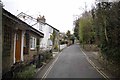
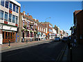
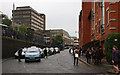
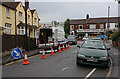
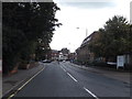
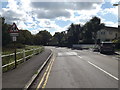
Living in CM14 4RP places you in the heart of Brentwood’s urban core, a small residential cluster within the larger Brentwood Borough in Essex. The area covers 856 m² and is home to 2,183 residents, creating a densely populated yet compact community. Positioned near the town centre on William Hunter Way, CM14 4RP is part of the Brentwood South district, a ward classified as least deprived in the Index of Multiple Deprivation. Daily life here is shaped by proximity to local amenities, with the High Street serving as a central hub. The area’s character is defined by its mix of residential properties and access to nearby services, including schools, retail, and transport links. While the population is relatively small, the density means a tight-knit community feel, though it remains a small postcode area with limited housing stock. Its location within the Chelmsford travel to work area also connects residents to broader economic opportunities.
- Area Type
- Postcode
- Area Size
- 856 m²
- Population
- 2183
- Population Density
- 4067 people/km²
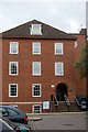
The property market in CM14 4RP is characterised by a high rate of home ownership (62%) and a predominance of houses over flats. This suggests a residential area where property is primarily owner-occupied rather than rented, which may appeal to those seeking long-term stability. The small size of the postcode area means housing stock is limited, with properties likely concentrated in the immediate vicinity of William Hunter Way and the Brentwood town centre. Buyers should consider the compact nature of the area, which may limit options for expansion or relocation within the same postcode. The presence of houses rather than flats indicates a focus on family-friendly or semi-detached living, though the exact range of property types is not specified. For those prioritising proximity to amenities, the area’s proximity to retail, transport, and schools could be a key draw.
House Prices in CM14 4RP
No properties found in this postcode.
Energy Efficiency in CM14 4RP
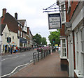
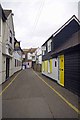
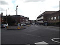
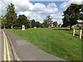
Residents of CM14 4RP enjoy a range of amenities within walking or short driving distance. Retail options include Tesco High, Iceland Brentwood, and M&S Brentwood, offering everyday shopping needs. The High Street is a focal point for local activity, with nearby pharmacies and services. For healthcare, Nuffield Health Brentwood and Brentwood Community Hospital are within 0.5–0.7 miles. The area’s urban setting also provides access to parks and open spaces, though specific names are not listed in the data. The presence of multiple rail and metro stations, combined with bus routes, ensures ease of travel for leisure, work, or shopping. This mix of retail, healthcare, and transport options creates a convenient lifestyle, particularly for those prioritising accessibility over expansive green spaces. The compact nature of the area means amenities are closely clustered, reducing travel time for daily errands.
Amenities
Schools
Residents of CM14 4RP have access to two primary schools within practical reach. St Thomas of Canterbury Church of England Aided Primary School in Brentwood is Ofsted-rated as good, offering a reliable educational option for older children. Just 0.6 miles away is St Thomas of Canterbury Church of England Aided Infant School, which caters to younger pupils. Both institutions are part of the same educational trust, suggesting a cohesive approach to teaching and support for families. The proximity of these schools—within 800 yards of the area—makes CM14 4RP appealing for parents seeking convenient access to education. The presence of two primary schools in close proximity also reduces travel time for families, though no secondary schools are listed in the data. This mix of primary schools ensures coverage for early years education but may require additional planning for secondary schooling.
| Rank | School | Type | Entry gender | Ages |
|---|
Explore more schools in this area
Go to Schools tabDemographics
The community in CM14 4RP is predominantly composed of adults aged 30–64, with a median age of 47. This suggests a mature population, likely with established careers and families. Home ownership is high at 62%, reflecting a stable residential base, and the primary accommodation type is houses rather than flats. The predominant ethnic group is White, though no specific data on diversity beyond this is provided. The area’s deprivation rank of 24,441/32,844 indicates it is among the least deprived in England, which correlates with an average household income of £58,900. This financial stability likely supports a quality of life with access to services and amenities. The absence of specific data on other ethnic groups or younger demographics means the community profile is largely defined by its adult population and homeownership trends.
Household Size
Accommodation Type
Tenure
Ethnic Group
Religion
Household Composition
Age
Household Deprivation
NS-SEC
Explore more demographic insights in this area
Go to Demographics tabPlanning
Planning Constraints
- Flood RiskPremium
- Ramsar Wetland SitesPremium
- Area of Outstanding Natural BeautyPremium
- Protected Nature ReservePremium
- Protected WoodlandPremium