Area Overview for CM13 3FR
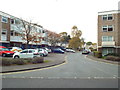
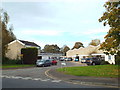
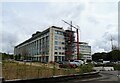
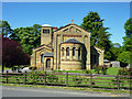
Photos of CM13 3FR

Area Information
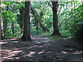
CM13 3FR is a small residential postcode area in the Borough of Brentwood, Essex, covering just 2.1 hectares with a population of 1799 people. This translates to a population density of 83,948 people per square kilometre, reflecting a tightly packed suburban cluster. The area lies south of Brentwood town centre, bordered by the M25 motorway and the Great Eastern Main Line railway. Historically, it was shaped by medieval manors and 19th-century railway development, with estates like Warley Barracks and Clements Park defining its character. Daily life here blends suburban convenience with rural pockets, including green spaces like Warley Country Park and Hampden Wood. Residents benefit from proximity to Brentwood’s amenities, while the area’s compact size means most needs are within walking or cycling distance. With a median age of 47 and a majority of adults aged 30–64, the community is established but not static, with a mix of long-term residents and newer arrivals drawn by the area’s accessibility and affordability.
- Area Type
- Postcode
- Area Size
- 2.1 hectares
- Population
- 1799
- Population Density
- 3585 people/km²
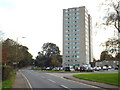
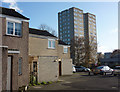
The property market in CM13 3FR is defined by its high density and prevalence of flats, with 51% of residents owning their homes. This suggests a mix of owner-occupied and rental properties, though the exact proportion of rentals is not specified. The area’s compact size means housing stock is limited, with most properties concentrated in estates like Warley Barracks and Clements Park. Flats dominate, likely due to the area’s post-war development and proximity to transport links. For buyers, this means a focus on smaller, well-maintained units rather than detached homes. The high population density may also mean competition for available properties, particularly near amenities like schools and rail stations. Given the area’s location near the M25 and Brentwood, it appeals to commuters seeking affordable housing with easy access to London. However, the limited space and flat-dominated stock may not suit those prioritising larger homes or garden space.
House Prices in CM13 3FR
Showing 93 properties
| Address | Type | Beds | Baths | Last Sale Price | Last Sale Date | |
|---|---|---|---|---|---|---|
| Suite G10, Jubilee House, The Drive, Great Warley, CM13 3FR | Office | - | - | - | - | |
| Suite G09, Jubilee House, The Drive, Great Warley, CM13 3FR | Office | - | - | - | - | |
| Suite G07, Jubilee House, The Drive, Great Warley, CM13 3FR | Office | - | - | - | - | |
| Suite G08, Jubilee House, The Drive, Great Warley, CM13 3FR | Office | - | - | - | - | |
| Suite G17, Jubilee House, The Drive, Great Warley, CM13 3FR | Office | - | - | - | - | |
| Suite G04, Jubilee House, The Drive, Great Warley, CM13 3FR | Office | - | - | - | - | |
| Regus, Jubilee House, The Drive, Great Warley, CM13 3FR | office_workshop | - | - | - | - | |
| Suite 208, Jubilee House, The Drive, Great Warley, CM13 3FR | Office | - | - | - | - | |
| Suite G24, Jubilee House, The Drive, Great Warley, CM13 3FR | Office | - | - | - | - | |
| Suite 212, Jubilee House, The Drive, Great Warley, CM13 3FR | Office | - | - | - | - |
Energy Efficiency in CM13 3FR
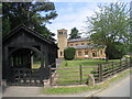
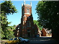
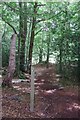
Living in CM13 3FR offers a blend of suburban convenience and accessible amenities. Nearby retail options include Waitrose Little, Tesco Warley, and Budgens Brentwood, providing essential shopping within reach. The area’s proximity to Warley Country Park, Hampden Wood, and Warley Playing Fields offers green spaces for walking, cycling, and outdoor activities. Pubs like the Essex Arms and Brave Nelson add a social dimension, while the nearby Spire Hartswood Hospital and historic sites like the Essex Regiment Chapel provide cultural and healthcare access. The mix of retail, transport, and green spaces supports a lifestyle that balances daily needs with leisure. Residents can enjoy a compact, walkable environment with minimal need to travel far for essentials, though the area’s density means some amenities are concentrated in nearby Brentwood.
Amenities
Schools
The nearest school to CM13 3FR is Warley Primary School, which serves the local community and has an Ofsted rating of ‘good’. This indicates a reliable foundation for primary education, though no secondary schools are listed in the data. The presence of a primary school with a positive rating is a key factor for families, as it reduces the need for long commutes to education. However, parents seeking secondary schooling may need to look beyond the immediate area, as the data does not mention nearby secondary institutions. The school’s ‘good’ rating suggests a focus on quality teaching and facilities, which can be a deciding factor for homebuyers prioritising education for their children. The mix of school types in the area remains limited, with only primary options readily accessible.
| Rank | School | Type | Entry gender | Ages |
|---|
Explore more schools in this area
Go to Schools tabDemographics
The population of CM13 3FR is predominantly adults, with 47 as the median age and 30–64-year-olds making up the most common age group. Home ownership stands at 51%, meaning nearly half of residents live in properties they own, while the remaining 49% are likely to rent. The accommodation type is primarily flats, reflecting the area’s post-war development and high density. The predominant ethnic group is White, though specific data on diversity is not provided. The age profile suggests a mature, stable community with a focus on family living, given the presence of Warley Primary School. However, the high population density may contribute to a sense of proximity and shared resources, though it also means limited space for expansion. The demographic mix indicates a balance between long-term residents and those seeking affordable housing in a commuter-friendly location.
Household Size
Accommodation Type
Tenure
Ethnic Group
Religion
Household Composition
Age
Household Deprivation
NS-SEC
Explore more demographic insights in this area
Go to Demographics tabPlanning
Planning Constraints
- Flood RiskPremium
- Ramsar Wetland SitesPremium
- Area of Outstanding Natural BeautyPremium
- Protected Nature ReservePremium
- Protected WoodlandPremium