Area Overview for CM13 3AT
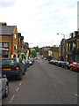
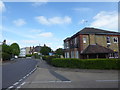
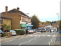
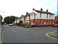
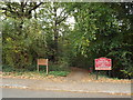
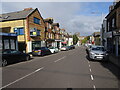
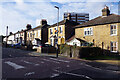
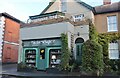
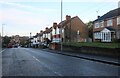
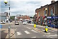
Photos of CM13 3AT


Area Information
CM13 3AT is a compact residential postcode in the Warley district of Brentwood, Essex. With a population of 1,799 spread across 6,292 square metres, it is one of the most densely populated areas in England, at 285,914 people per square kilometre. The area blends suburban living with rural elements, centred around Warley Hill and estates like Clements Park and Warley Mount. Historically rooted in medieval manors recorded in the Domesday Book, modern development accelerated with the expansion of the Eastern Counties railway in the 19th century. Today, it sits near the M25 motorway and the Great Eastern Main Line, offering proximity to London while retaining pockets of green space such as Warley Country Park and Hampden Wood. Daily life here is shaped by its mix of residential clusters and nearby amenities, including schools, pubs, and transport hubs. The area’s compact size means residents often live within walking distance of local shops, community facilities, and green spaces, creating a tight-knit environment with a distinct character.
- Area Type
- Postcode
- Area Size
- 6292 m²
- Population
- 1799
- Population Density
- 3585 people/km²
The property market in CM13 3AT is characterised by a 51% home ownership rate, with flats being the primary accommodation type. This suggests a housing stock that leans towards smaller, purpose-built units, often found in residential estates like Warley Mount and Hartswood. The area’s compact size means property availability is limited, and buyers should consider nearby postcode areas for more options. The prevalence of flats may appeal to first-time buyers or those seeking lower-maintenance living, though the lack of larger homes could be a drawback for growing families. With 49% of properties rented, the market is not dominated by a single buyer type, but the small area size means competition for available properties is likely. Prospective buyers should also note that the housing stock’s age and design may influence long-term value, particularly in estates developed in the mid-20th century.
House Prices in CM13 3AT
No properties found in this postcode.
Energy Efficiency in CM13 3AT
Living in CM13 3AT offers access to a range of amenities within practical reach. Retail options include Waitrose Little, Tesco Warley, and Budgens Brentwood, providing everyday shopping needs. Pubs such as the Essex Arms and Brave Nelson offer social spaces, while green spaces like Warley Country Park and Hampden Wood provide opportunities for walking, cycling, or relaxation. The area also includes community facilities such as churches, cemeteries, and the Spire Hartswood Hospital. Nearby, Warley Playing Fields and Donkey Lane Plantation add to the recreational options. The mix of shops, green spaces, and local landmarks creates a convenient lifestyle, blending suburban comfort with access to nature. For residents, this balance of amenities supports both daily living and leisure, though the area’s compact size means some services may require a short trip to adjacent postcode areas.
Amenities
Schools
The nearest school to CM13 3AT is Warley Primary School, which has an Ofsted rating of "good." This primary school serves the local community, offering education for younger children. However, the data does not list any secondary schools in the immediate vicinity, meaning families may need to look beyond the postcode for secondary education. The presence of a well-rated primary school is a positive for parents prioritising early education, though the absence of secondary options could be a consideration for those planning long-term stays. The school’s "good" rating indicates satisfactory standards in teaching and facilities, but further research would be needed to assess its performance in specific subjects or extracurricular offerings.
| Rank | School | Type | Entry gender | Ages |
|---|
Explore more schools in this area
Go to Schools tabDemographics
The population of CM13 3AT has a median age of 47, with the majority of residents aged 30–64. This suggests a community skewed towards middle-aged adults, many of whom may be established professionals or families. Home ownership accounts for 51% of households, with the remaining 49% likely to be renters, indicating a mix of owner-occupied and rental properties. The predominant accommodation type is flats, reflecting a housing stock tailored to smaller living spaces. The predominant ethnic group is White, though specific data on diversity is not provided. The age profile and ownership rates suggest a stable, mature demographic with long-term residency patterns. For quality of life, the high proportion of adults in the 30–64 age range may support local services and community engagement, though the lack of detailed diversity data limits deeper analysis of social dynamics.
Household Size
Accommodation Type
Tenure
Ethnic Group
Religion
Household Composition
Age
Household Deprivation
NS-SEC
Explore more demographic insights in this area
Go to Demographics tabPlanning
Planning Constraints
- Flood RiskPremium
- Ramsar Wetland SitesPremium
- Area of Outstanding Natural BeautyPremium
- Protected Nature ReservePremium
- Protected WoodlandPremium