Area Overview for CM13 2QJ
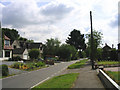
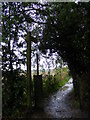
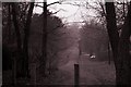
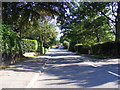
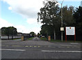
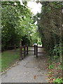
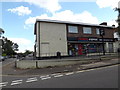
Photos of CM13 2QJ
Area Information
CM13 2QJ is a small residential cluster covering a precise 5277 square metres. This compact area forms part of the Hutton East ward within the Brentwood Borough Council. It sits approximately three miles east of Brentwood town centre on the eastern edge of the built-up area. The region blends historic roots with modern convenience. Historical records from the Domesday Book of 1086 list Hutton as a settlement with 24 households owned by Battle Abbey. The name itself translates to a farm or settlement on a hill spur. Today, life here revolves around the designated conservation area surrounding Hutton All Saints' Church and the neighbouring Hutton Country Park. Residents enjoy a suburban setting that lies 20 miles from Central London. A Shenfield railway station provides access to the capital, located just one mile from this district. The postcode covers a specific density of 1300 people per square kilometre. You live in an environment where history and contemporary living intersect. The area remains a quiet residential zone rather than a bustling commercial hub.
- Area Type
- Postcode
- Area Size
- 5277 m²
- Population
- 2512
- Population Density
- 1300 people/km²
Your property search for CM13 2QJ focuses on a distinct market dominated by owner-occupiers. High home ownership levels confirm that 89% of residents hold their properties outright. This statistic reflects a stock primarily composed of houses rather than rental units. The area attracts buyers looking for permanent homes rather than investment flats. With 89% ownership, you are entering a market where turnover may be lower but potential vendors are committed to the locality. The specific postcode covers a small footprint of 5277 square metres, indicating limited new build development in this exact cluster. Instead, the available housing likely comprises existing stock adapted for local needs. The demolition of the civil parish in 1934 and subsequent absorption into Brentwood Urban District shaped the current housing patterns. You can expect a traditional residential streetscape rather than modern apartment blocks. This stability makes the area attractive for families seeking a long-term base. The market operates on the principles of a classic English suburb with a strong link to local heritage and conservation areas.
House Prices in CM13 2QJ
Showing 5 properties
| Address | Type | Beds | Baths | Last Sale Price | Last Sale Date | |
|---|---|---|---|---|---|---|
| 149 Hanging Hill Lane, Hutton, CM13 2QJ | house | - | - | £1,290,000 | Sep 2018 | |
| Russets, 182 Hanging Hill Lane, Hutton, CM13 2QJ | Bungalow | 4 | - | £552,000 | Dec 2010 | |
| 184 Hanging Hill Lane, Hutton, CM13 2QJ | Detached | - | - | £190,000 | Oct 1996 | |
| 151 Hanging Hill Lane, Hutton, CM13 2QJ | Detached | - | - | - | - | |
| Hill Cottage, 186 Hanging Hill Lane, Hutton, CM13 2QJ | Detached | - | - | - | - |
Energy Efficiency in CM13 2QJ
Daily life in CM13 2QJ benefits from amenities within short walking or driving distance. Five retail options serve the immediate needs of residents, including Tesco Brentwood and the Co-op Rayleigh. You have access to a branch of M&S on Hutton Mount BP for varied shopping needs. Five railway stations serve the wider area, with Shenfield Railway Station, Brentwood Railway Station, and Billericay Railway Station offering frequent departures. These rail links connect you to Central London and beyond. Hutton Country Park lies nearby on former farmland bounded by the River Wid. This local nature reserve offers a space for walking and relaxation close to your home. The conservation area around Hutton All Saints' Church adds historical charm to your daily walks. You are five kilometres from the edge of the built-up area where the village character persists. The proximity to Rayleigh Road housing and farmland provides a green buffer. Your lifestyle combines access to major retailers like the Co-op with the tranquility of the countryside edge.
Amenities
Schools
Families living in CM13 2QJ have access to several educational institutions within practical reach. St Martin's School serves as a primary school option for younger children. For those seeking private education, Herington House School operates as an independent school in the vicinity. St Martin's School Brentwood also functions as a nearby academy. This academy holds a good Ofsted rating, which serves as a key indicator of educational quality. You will find a mix of state-funded academies and private options. This variety allows parents to choose between comprehensive academies and independent institutions without travelling far. The presence of a good-rated academy provides a solid state education alternative. The independent school option caters to families prepared for private tuition. These schools are situated near the residential cluster, reducing commute times for students. The educational provision supports the high home ownership rate and the affluent demographic profile of the area. You do not need to look beyond this neighbourhood to secure quality schooling for your children.
| Rank | School | Type | Entry gender | Ages |
|---|
Explore more schools in this area
Go to Schools tabDemographics
The community within CM13 2QJ is defined by a stable population of 2512 people living in houses. The median age stands at 47 years, making Adults aged between 30 and 64 the most common age range. This data indicates a mature demographic focused on stability. Home ownership is exceptionally high in this postcode, with 89% of residents owning their properties. Only a small minority rent in this area. The predominant ethnic group within the population is White. Living here means you join a neighbourhood characterised by long-term residency rather than temporary tenancies. The high concentration of homeowners suggests a community invested in the local area. There is a clear lack of young adults in the under-thirty bracket or older retirees in significant numbers. The accommodation consists primarily of houses rather than flats or apartments. This profile creates a quiet, established atmosphere suitable for families or those seeking a settled home life. You are entering an environment where neighbours are likely to have resided in their homes for many years.
Household Size
Accommodation Type
Tenure
Ethnic Group
Religion
Household Composition
Age
Household Deprivation
NS-SEC
Explore more demographic insights in this area
Go to Demographics tabPlanning
Planning Constraints
- Flood RiskPremium
- Ramsar Wetland SitesPremium
- Area of Outstanding Natural BeautyPremium
- Protected Nature ReservePremium
- Protected WoodlandPremium