Area Overview for CM11 2XE
Photos of CM11 2XE


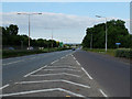
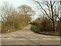
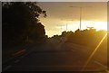
9 photos from this area
Area Information
Key information about the CM11 2XE including its size, population, and administrative classification.
- Area Type
- Postcode
- Area Size
- 70.2 hectares
- Population
- 1467
- Population Density
- 337 people/km²
House Prices in CM11 2XE
17
Properties
£457,188
Average Sold Price
£150,000
Lowest Price
£875,000
Highest Price
Showing 17 properties
| Address | Type | Beds | Baths | Last Sale Price | Last Sale Date | |
|---|---|---|---|---|---|---|
| Oakmead, Gardiners Lane North, Billericay, CM11 2XE | Detached | 3 | 2 | £875,000 | Oct 2024 | |
| Aviary Supplies, Pylon Nursery, Gardiners Lane North, Billericay, CM11 2XE | Bungalow | - | - | £750,000 | May 2024 | |
| 4, Gardiners Cottages, Gardiners Lane North, Billericay, CM11 2XE | Detached | 4 | 2 | £440,000 | Oct 2019 | |
| 2, Gardiners Cottages, Gardiners Lane North, Billericay, CM11 2XE | Detached | 4 | 1 | £390,000 | Jul 2011 | |
| Sylvan Rest, Gardiners Lane North, Billericay, CM11 2XE | Detached | - | - | £402,500 | Dec 2006 | |
| The Warren, Gardiners Lane North, Billericay, CM11 2XE | Detached | - | - | £150,000 | Jul 2001 | |
| Eastview, Gardiners Lane North, Billericay, CM11 2XE | Detached | - | - | £185,000 | May 2000 | |
| Oaklands, Gardiners Lane North, Billericay, CM11 2XE | Detached | - | - | £465,000 | May 2000 | |
| Mobile At Great Wasketts Farm, Gardiners Lane North, Billericay, CM11 2XE | Land | - | 1 | - | - | |
| Gardiners View, Gardiners Lane North, Billericay, CM11 2XE | Detached | - | - | - | - |
Page 1 of 2
Energy Efficiency in CM11 2XE
Amenities
Schools
| Rank | School | Type | Entry gender | Ages |
|---|
Explore more schools in this area
Go to Schools tabDemographics
Household Size
Family (3-5 people)
most common
Accommodation Type
Houses
most common
Tenure
91
majority
Ethnic Group
White
most common
Religion
N/A
most common
Household Composition
N/A
most common
Age
47
median
Adults (30-64 years)
most common
Household Deprivation
N/A
with no deprivation
NS-SEC
39
in Lower managerial occupations
Explore more demographic insights in this area
Go to Demographics tabPlanning
Planning Constraints
- Flood RiskPremium
- Ramsar Wetland SitesPremium
- Area of Outstanding Natural BeautyPremium
- Protected Nature ReservePremium
- Protected WoodlandPremium