Area Overview for CM11 2YG
Photos of CM11 2YG
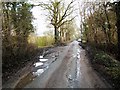
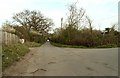
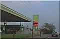
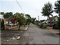

8 photos from this area
Area Information
Key information about the CM11 2YG including its size, population, and administrative classification.
- Area Type
- Postcode
- Area Size
- 13.7 hectares
- Population
- 1821
- Population Density
- 275 people/km²
House Prices in CM11 2YG
25
Properties
£495,833
Average Sold Price
£40,000
Lowest Price
£975,000
Highest Price
Showing 25 properties
| Address | Type | Beds | Baths | Last Sale Price | Last Sale Date | |
|---|---|---|---|---|---|---|
| Fairview, Oak Road, Billericay, CM11 2YG | Detached | 4 | 3 | £975,000 | Jul 2023 | |
| Rose Villa Lodge, Oak Road, Billericay, CM11 2YG | Detached | - | - | £340,000 | Oct 2021 | |
| Enfin, Oak Road, Billericay, CM11 2YG | Bungalow | 4 | 2 | £460,000 | Jan 2021 | |
| Oakwood Barn, Oak Road, Billericay, CM11 2YG | Semi-detached | 2 | 1 | £385,000 | Jan 2019 | |
| Oaks Cray Farm, Oak Road, Billericay, CM11 2YG | Terraced | - | - | £40,000 | Aug 2014 | |
| The Sheiling, Oak Road, Billericay, CM11 2YG | Bungalow | - | - | £775,000 | Nov 2002 | |
| The Lavenders, Oak Road, Billericay, CM11 2YG | Bungalow | 4 | 2 | - | - | |
| The Woodmans, Oak Road, Billericay, CM11 2YG | Detached | 3 | - | - | - | |
| 6A Oak Road, Billericay, CM11 2YG | Detached | 3 | - | - | - | |
| Oaklees, Oak Lane, Billericay, CM11 2YG | Mobile Home | - | - | - | - |
Page 1 of 3
Energy Efficiency in CM11 2YG
Amenities
Schools
| Rank | School | Type | Entry gender | Ages |
|---|
Explore more schools in this area
Go to Schools tabDemographics
Household Size
Family (3-5 people)
most common
Accommodation Type
Houses
most common
Tenure
87
majority
Ethnic Group
White
most common
Religion
N/A
most common
Household Composition
N/A
most common
Age
47
median
Adults (30-64 years)
most common
Household Deprivation
N/A
with no deprivation
NS-SEC
36
in Lower managerial occupations
Explore more demographic insights in this area
Go to Demographics tabPlanning
Planning Constraints
- Flood RiskPremium
- Ramsar Wetland SitesPremium
- Area of Outstanding Natural BeautyPremium
- Protected Nature ReservePremium
- Protected WoodlandPremium