Area Overview for CM1 6EF
Photos of CM1 6EF
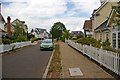
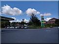
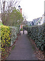
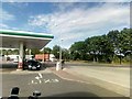

11 photos from this area
Area Information
Key information about the CM1 6EF including its size, population, and administrative classification.
- Area Type
- Postcode
- Area Size
- 2.1 hectares
- Population
- 1779
- Population Density
- 1583 people/km²
House Prices in CM1 6EF
19
Properties
£515,679
Average Sold Price
£110,000
Lowest Price
£935,000
Highest Price
Showing 19 properties
| Address | Type | Beds | Baths | Last Sale Price | Last Sale Date | |
|---|---|---|---|---|---|---|
| 1 Multon Lea, Chelmsford Garden Community, Chelmsford, CM1 6EF | Detached | 7 | 3 | £743,000 | Jun 2024 | |
| 3 Multon Lea, Chelmsford Garden Community, Chelmsford, CM1 6EF | house | - | - | £935,000 | Dec 2022 | |
| 4 Multon Lea, Chelmsford Garden Community, Chelmsford, CM1 6EF | Retail | 3 | 3 | £650,000 | Sep 2022 | |
| 17 Multon Lea, Chelmsford Garden Community, Chelmsford, CM1 6EF | house | - | - | £875,000 | Nov 2019 | |
| 9 Multon Lea, Chelmsford Garden Community, Chelmsford, CM1 6EF | Detached | 2 | 3 | £402,000 | Sep 2018 | |
| 7 Multon Lea, Chelmsford Garden Community, Chelmsford, CM1 6EF | Detached | 4 | 4 | £670,000 | Apr 2017 | |
| 19 Multon Lea, Chelmsford Garden Community, Chelmsford, CM1 6EF | Detached | - | - | £560,000 | May 2005 | |
| 21 Multon Lea, Chelmsford Garden Community, Chelmsford, CM1 6EF | Detached | - | - | £492,000 | Mar 2005 | |
| 16 Multon Lea, Chelmsford Garden Community, Chelmsford, CM1 6EF | house | 5 | - | £492,500 | Jun 2003 | |
| 10 Multon Lea, Chelmsford Garden Community, Chelmsford, CM1 6EF | Detached | - | - | £435,000 | Oct 2002 |
Page 1 of 2
Energy Efficiency in CM1 6EF
Amenities
Schools
| Rank | School | Type | Entry gender | Ages |
|---|
Explore more schools in this area
Go to Schools tabDemographics
Household Size
Family (3-5 people)
most common
Accommodation Type
Houses
most common
Tenure
69
majority
Ethnic Group
White
most common
Religion
N/A
most common
Household Composition
N/A
most common
Age
47
median
Adults (30-64 years)
most common
Household Deprivation
N/A
with no deprivation
NS-SEC
48
in Lower managerial occupations
Explore more demographic insights in this area
Go to Demographics tabPlanning
Planning Constraints
- Flood RiskPremium
- Ramsar Wetland SitesPremium
- Area of Outstanding Natural BeautyPremium
- Protected Nature ReservePremium
- Protected WoodlandPremium