Area Overview for CM1 6BE
Photos of CM1 6BE
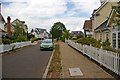
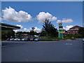
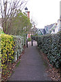
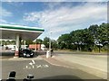
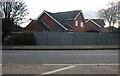
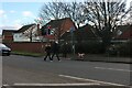
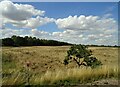
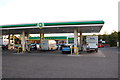
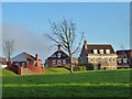
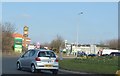
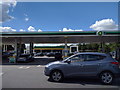
11 photos from this area
Area Information
Key information about the CM1 6BE including its size, population, and administrative classification.
- Area Type
- Postcode
- Area Size
- 2.4 hectares
- Population
- 1779
- Population Density
- 1583 people/km²
House Prices in CM1 6BE
16
Properties
£708,563
Average Sold Price
£299,950
Lowest Price
£1,250,000
Highest Price
Showing 16 properties
| Address | Type | Beds | Baths | Last Sale Price | Last Sale Date | |
|---|---|---|---|---|---|---|
| 14 Sidney Place, Chelmsford Garden Community, Chelmsford, CM1 6BE | Detached | 5 | 4 | £1,250,000 | Nov 2022 | |
| 17 Sidney Place, Chelmsford Garden Community, Chelmsford, CM1 6BE | Detached | 5 | 4 | £1,035,000 | Aug 2021 | |
| 2 Sidney Place, Chelmsford Garden Community, Chelmsford, CM1 6BE | house | - | - | £1,145,000 | Feb 2020 | |
| 11 Sidney Place, Chelmsford Garden Community, Chelmsford, CM1 6BE | house | - | - | £870,000 | Feb 2020 | |
| 8 Sidney Place, Chelmsford Garden Community, Chelmsford, CM1 6BE | Detached | 4 | - | £730,000 | Dec 2019 | |
| 12 Sidney Place, Chelmsford Garden Community, Chelmsford, CM1 6BE | house | - | - | £875,000 | Apr 2018 | |
| 7 Sidney Place, Chelmsford Garden Community, Chelmsford, CM1 6BE | house | - | - | £780,000 | Dec 2016 | |
| 1 Sidney Place, Chelmsford Garden Community, Chelmsford, CM1 6BE | Detached | 5 | - | £299,950 | Jul 2011 | |
| 15 Sidney Place, Chelmsford Garden Community, Chelmsford, CM1 6BE | Detached | - | - | £575,000 | Mar 2008 | |
| 13 Sidney Place, Chelmsford Garden Community, Chelmsford, CM1 6BE | Detached | - | - | £620,000 | Feb 2008 |
Page 1 of 2
Energy Efficiency in CM1 6BE
Amenities
Schools
| Rank | School | Type | Entry gender | Ages |
|---|
Explore more schools in this area
Go to Schools tabDemographics
Household Size
Family (3-5 people)
most common
Accommodation Type
Houses
most common
Tenure
69
majority
Ethnic Group
White
most common
Religion
N/A
most common
Household Composition
N/A
most common
Age
47
median
Adults (30-64 years)
most common
Household Deprivation
N/A
with no deprivation
NS-SEC
48
in Lower managerial occupations
Explore more demographic insights in this area
Go to Demographics tabPlanning
Planning Constraints
- Flood RiskPremium
- Ramsar Wetland SitesPremium
- Area of Outstanding Natural BeautyPremium
- Protected Nature ReservePremium
- Protected WoodlandPremium