Area Overview for CB9 9SB
Photos of CB9 9SB
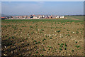
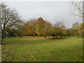
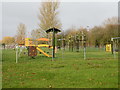
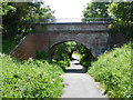
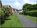
24 photos from this area
Area Information
Key information about the CB9 9SB including its size, population, and administrative classification.
- Area Type
- Postcode
- Area Size
- 5341 m²
- Population
- 2761
- Population Density
- 2702 people/km²
House Prices in CB9 9SB
27
Properties
£195,561
Average Sold Price
£52,500
Lowest Price
£290,000
Highest Price
Showing 27 properties
| Address | Type | Beds | Baths | Last Sale Price | Last Sale Date | |
|---|---|---|---|---|---|---|
| 43 Chapelwent Road, Haverhill, CB9 9SB | Semi-detached | 3 | 2 | £290,000 | Aug 2025 | |
| 53 Chapelwent Road, Haverhill, CB9 9SB | Terraced | 3 | 2 | £147,500 | Jun 2025 | |
| 55 Chapelwent Road, Haverhill, CB9 9SB | Semi-detached | 3 | 2 | £112,000 | Dec 2022 | |
| 41 Chapelwent Road, Haverhill, CB9 9SB | Terraced | 3 | - | £279,950 | Jun 2021 | |
| 47 Chapelwent Road, Haverhill, CB9 9SB | Semi-detached | 3 | - | £260,000 | May 2021 | |
| 39 Chapelwent Road, Haverhill, CB9 9SB | house | 3 | - | £279,950 | Mar 2021 | |
| 37 Chapelwent Road, Haverhill, CB9 9SB | Semi-detached | 3 | 2 | £272,500 | Mar 2021 | |
| 31 Chapelwent Road, Haverhill, CB9 9SB | Terraced | 2 | - | £198,500 | Feb 2021 | |
| 17 Chapelwent Road, Haverhill, CB9 9SB | Terraced | 3 | 2 | £275,000 | Feb 2019 | |
| 21 Chapelwent Road, Haverhill, CB9 9SB | Semi-detached | 3 | 3 | £245,000 | Dec 2018 |
Page 1 of 3
Energy Efficiency in CB9 9SB
Amenities
Schools
| Rank | School | Type | Entry gender | Ages |
|---|
Explore more schools in this area
Go to Schools tabDemographics
Household Size
Family (3-5 people)
most common
Accommodation Type
Houses
most common
Tenure
57
majority
Ethnic Group
White
most common
Religion
N/A
most common
Household Composition
N/A
most common
Age
47
median
Adults (30-64 years)
most common
Household Deprivation
N/A
with no deprivation
NS-SEC
28
in Lower managerial occupations
Explore more demographic insights in this area
Go to Demographics tabPlanning
Planning Constraints
- Flood RiskPremium
- Ramsar Wetland SitesPremium
- Area of Outstanding Natural BeautyPremium
- Protected Nature ReservePremium
- Protected WoodlandPremium