Area Overview for CB9 8NW
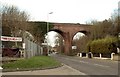
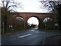
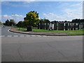
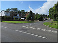
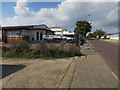
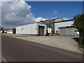
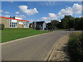
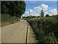
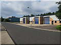
Photos of CB9 8NW


Area Information
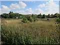
It is a specific postcode area covering a small residential cluster in Suffolk that forms part of the wider Haverhill market town. The site comprises 4164 square metres and is surrounded by established character more than modern development. Living in CB9 8NW offers a grounded experience within a town documented in the Domesday Book, creating a sense of continuity with the town's nine-centuries of history. The immediate surroundings date back to pre-Roman times, with Iron Age artefacts discovered nearby and a medieval church established on Burton End. This is not a location defined by rapid change but by the persistence of long-standing structures and street patterns. You will find yourself in one of the lesser wool towns that ascended during the fourteenth century and maintained its weaving legacy for centuries. Today, the area sits next to the borders of Essex and Cambridgeshire, functioning as a quiet extension of Haverhill's commercial significance. The small footprint of 4164 square metres ensures that life here remains walkable and intimate while still providing access to the ancient market centre known for its Tudor-era houses and Victorian buildings.
- Area Type
- Postcode
- Area Size
- 4164 m²
- Population
- 2111
- Population Density
- 2113 people/km²
The housing stock is characterised by a steady presence of owner-occupied residences rather than rental properties or new-build estates. Sixty per cent of homes in CB9 8NW are owned outright or with a mortgage, which generally contributes to greater investment and better maintenance standards. This high level of home ownership typically means that the area feels settled, with residents taking a long-term view on their properties. The architecture is consistent, with Houses forming the predominant accommodation type, meaning you will see detached or semi-detached structures rather than high-density flats. This fits the pattern of a town that functioned as a weaving centre and a minor administrative district since 1894, where educational and community infrastructure has developed over time. Buyers looking at CB9 8NW should expect traditional property stock that aligns with the town's history as a market town with documented commercial significance. The environment lacks the churn common in student towns or commuter hubs dominated by landlords. Instead, the market reflects the stability of a civil parish with a small population of 2111. For those seeking a property, the availability of houses supports a quiet life where ownership is the primary mode of engagement with the built environment.
House Prices in CB9 8NW
Showing 7 properties
| Address | Type | Beds | Baths | Last Sale Price | Last Sale Date | |
|---|---|---|---|---|---|---|
| 1 Lee Walk, Haverhill, CB9 8NW | Detached | 3 | 2 | £292,000 | Jul 2020 | |
| 6 Lee Walk, Haverhill, CB9 8NW | Detached | 4 | - | £345,000 | Sep 2018 | |
| 8 Lee Walk, Haverhill, CB9 8NW | Detached | 4 | - | £355,000 | Dec 2016 | |
| 2 Lee Walk, Haverhill, CB9 8NW | house | - | - | £245,995 | Apr 2015 | |
| 4 Lee Walk, Haverhill, CB9 8NW | house | - | - | £249,995 | Apr 2015 | |
| 10 Lee Walk, Haverhill, CB9 8NW | house | - | - | £314,995 | Apr 2015 | |
| 3 Lee Walk, Haverhill, CB9 8NW | house | - | - | £282,995 | Oct 2014 |
Energy Efficiency in CB9 8NW
Daily life in CB9 8NW revolves around practical proximity to essential services just a short walk away. You will find five retail outlets within practical reach, ensuring your shopping needs are met without requiring a long car journey. Specific venues include Lidl Haverhill, Spar, and Iceland Haverhill, all situated to serve the immediate residential cluster. These supermarkets provide daily necessities ranging from groceries to frozen foods, offering convenience for those living in houses throughout the area. The blend of international and local chains means you have options for budget shopping as well as quick top-ups. Beyond these fundamentals, the area is embedded within Haverhill, a town renowned for its Corn Exchange and Anne of Cleves House. While the specific amenities listed for CB9 8NW focus on retail, the broader context of living here includes access to a town with a museum, listed buildings, and a market history stretching back to 1050. The presence of Spar and Iceland Haverhill creates a routine where major errands are handled efficiently. This configuration supports a lifestyle where you drive or walk easily to your weekly shop before returning to your home in the residential cluster.
Amenities
Schools
| Rank | School | Type | Entry gender | Ages |
|---|
Explore more schools in this area
Go to Schools tabDemographics
The community in CB9 8NW has a median age of 47, meaning the population skews significantly toward maturity rather than youth. Most residents fall into the adult category, with the majority falling between 30 and 64 years old. This age profile suggests a neighbourhood dominated by families with grown children, empty nesters, or those approaching retirement. Home ownership stands at 60 per cent, indicating that two-thirds of households have secured their property independently rather than renting. The accommodation type data confirms that Houses form the primary buildings here, creating an environment rather than an apartment block setting. Ethnic diversity is minimal, with the predominant ethnic group identified as White, reflecting the town's tradition as a market centre dating back to the twelfth century. With a population of 2111 people, this small cluster maintains a familiar neighbourly dynamic. Although a population density figure of 506929 people per square kilometre is listed in the source data, it reflects the dense measurement of the specific postcode block rather than the spread across Haverhill. You can expect to live among people who have grown up or settled permanently in this specific locale rather than transients chasing temporary employment.
Household Size
Accommodation Type
Tenure
Ethnic Group
Religion
Household Composition
Age
Household Deprivation
NS-SEC
Explore more demographic insights in this area
Go to Demographics tabPlanning
Planning Constraints
- Flood RiskPremium
- Ramsar Wetland SitesPremium
- Area of Outstanding Natural BeautyPremium
- Protected Nature ReservePremium
- Protected WoodlandPremium