Area Overview for CB9 8EH
Photos of CB9 8EH
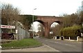
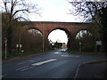
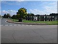
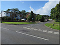


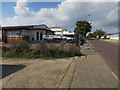
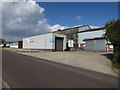
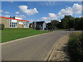
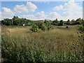
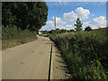
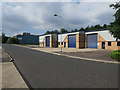
53 photos from this area
Area Information
Key information about the CB9 8EH including its size, population, and administrative classification.
- Area Type
- Postcode
- Area Size
- 1.8 hectares
- Population
- 1784
- Population Density
- 5617 people/km²
House Prices in CB9 8EH
36
Properties
£281,282
Average Sold Price
£70,000
Lowest Price
£545,000
Highest Price
Showing 36 properties
| Address | Type | Beds | Baths | Last Sale Price | Last Sale Date | |
|---|---|---|---|---|---|---|
| 34 Hamlet Road, Haverhill, CB9 8EH | Semi-detached | 3 | - | £332,000 | Oct 2025 | |
| 23 Hamlet Road, Haverhill, CB9 8EH | Terraced | 3 | 1 | £235,000 | Feb 2025 | |
| Airedale, 26 Hamlet Road, Haverhill, CB9 8EH | house | 5 | 2 | £545,000 | Aug 2024 | |
| Wesley Manse, 24 Hamlet Road, Haverhill, CB9 8EH | house | - | - | £450,000 | Jun 2024 | |
| Manor Croft, 40 Hamlet Road, Haverhill, CB9 8EH | Detached | 4 | 2 | £470,000 | Sep 2023 | |
| Fermain, 42 Hamlet Road, Haverhill, CB9 8EH | Detached | 4 | - | £440,000 | Aug 2022 | |
| 21A Hamlet Road, Haverhill, CB9 8EH | Terraced | 3 | 1 | £230,000 | May 2020 | |
| 32 Hamlet Road, Haverhill, CB9 8EH | Semi-detached | 3 | 1 | £275,000 | Sep 2019 | |
| Westward Ho, 18 Hamlet Road, Haverhill, CB9 8EH | Detached | 4 | - | £400,000 | Dec 2016 | |
| 31 Hamlet Road, Haverhill, CB9 8EH | Detached | 3 | - | £150,000 | Aug 2013 |
Page 1 of 4
Energy Efficiency in CB9 8EH
Amenities
Schools
| Rank | School | Type | Entry gender | Ages |
|---|
Explore more schools in this area
Go to Schools tabDemographics
Household Size
One person
most common
Accommodation Type
Houses
most common
Tenure
54
majority
Ethnic Group
White
most common
Religion
N/A
most common
Household Composition
N/A
most common
Age
47
median
Adults (30-64 years)
most common
Household Deprivation
N/A
with no deprivation
NS-SEC
26
in Lower managerial occupations
Explore more demographic insights in this area
Go to Demographics tabPlanning
Planning Constraints
- Flood RiskPremium
- Ramsar Wetland SitesPremium
- Area of Outstanding Natural BeautyPremium
- Protected Nature ReservePremium
- Protected WoodlandPremium