Area Overview for CB8 8SE
Photos of CB8 8SE
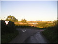
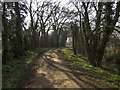
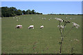
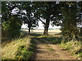

5 photos from this area
Area Information
Key information about the CB8 8SE including its size, population, and administrative classification.
- Area Type
- Postcode
- Area Size
- 4.8 hectares
- Population
- 2252
- Population Density
- 91 people/km²
House Prices in CB8 8SE
33
Properties
£286,957
Average Sold Price
£75,000
Lowest Price
£490,000
Highest Price
Showing 33 properties
| Address | Type | Beds | Baths | Last Sale Price | Last Sale Date | |
|---|---|---|---|---|---|---|
| 36 St Peters Avenue, Moulton, CB8 8SE | Bungalow | 3 | 1 | £400,000 | Mar 2025 | |
| 21 St Peters Avenue, Moulton, CB8 8SE | Semi-detached | 3 | 2 | £360,000 | Jun 2024 | |
| 9 St Peters Avenue, Moulton, CB8 8SE | Bungalow | 3 | 1 | £390,000 | Jun 2022 | |
| 4 St Peters Avenue, Moulton, CB8 8SE | Bungalow | - | - | £340,000 | Mar 2022 | |
| 13 St Peters Avenue, Moulton, CB8 8SE | Bungalow | 3 | 1 | £312,000 | Apr 2020 | |
| 1 St Peters Avenue, Moulton, CB8 8SE | house | - | - | £490,000 | Nov 2019 | |
| 18 St Peters Avenue, Moulton, CB8 8SE | Semi-detached | 4 | 2 | £385,000 | Dec 2018 | |
| 26 St Peters Avenue, Moulton, CB8 8SE | Bungalow | 4 | 2 | £370,000 | Oct 2016 | |
| 27 St Peters Avenue, Moulton, CB8 8SE | Bungalow | 3 | - | £295,000 | Sep 2015 | |
| 28 St Peters Avenue, Moulton, CB8 8SE | Bungalow | 2 | 1 | £230,000 | May 2015 |
Page 1 of 4
Energy Efficiency in CB8 8SE
Amenities
Schools
| Rank | School | Type | Entry gender | Ages |
|---|
Explore more schools in this area
Go to Schools tabDemographics
Household Size
Two person
most common
Accommodation Type
Houses
most common
Tenure
75
majority
Ethnic Group
White
most common
Religion
N/A
most common
Household Composition
N/A
most common
Age
47
median
Adults (30-64 years)
most common
Household Deprivation
N/A
with no deprivation
NS-SEC
45
in Lower managerial occupations
Explore more demographic insights in this area
Go to Demographics tabPlanning
Planning Constraints
- Flood RiskPremium
- Ramsar Wetland SitesPremium
- Area of Outstanding Natural BeautyPremium
- Protected Nature ReservePremium
- Protected WoodlandPremium